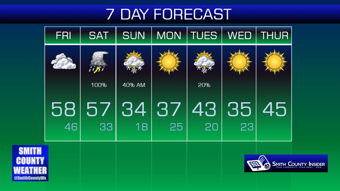
Friday, January 8th, 2016 — 4:16 PM
Saturday — On/off rain and thunderstorms. Wake up: 46°, Afternoon high: 57°. Winds SE at 5 to 10 mph.
NAM – 12 PM, Saturday:

Models seem to be in fairly general agreement that rain will arrive in our area around noon, give or take a couple of hours. We could see a few rumbles of thunder mixed in during the afternoon, with on and off showers persisting through the evening hours. The Storm Prediction Center has a Marginal Risk area for severe weather over parts of West Tennessee, but they currently only anticipate general thunderstorms in our area. We’ll keep an eye on things, but right now, we’re not concerned about severe weather.
As the rain begins to move out late Saturday night, temperatures will fall drastically as the cold front pushes through. With a little bit of moisture still in place as temperatures up above us fall below freezing, what could that mean?
NAM 4KM — 6 AM, Sunday:

It’s possible we could see some light snow or flurry activity during the morning hours of our Sunday. It does not appear that we will see any accumulation with this, at least anything significant to cause any type of concern, but don’t be surprised if you see flakes flying on your way to church.
We can just about guarantee it won’t look like this:

Any light snow or flurry activity looks to be over with by noon on Sunday, leaving us with a chilly afternoon in the low 30s and a breezy west wind that will only make it feel even colder.

As we head into our second work week of the new year, there’s another small possibility for light snow or flurries we’ll have to watch for Tuesday, but right now, it doesn’t look like anything to be concerned with — and really, what would you expect? It’s typical Tennessee January wanna-be-snow-but-probably-won’t shenanigans.
Extended: