Wednesday, February 17, 2016 — 1:58 PM
This Afternoon — Cloudy. Cold. High: 41°. Winds NW at 5 mph, becoming calm.
Today is about as “meh” as it gets. At least it’s not raining.

Temperatures overnight will drop below freezing, and with foggy conditions anticipated, we’ll have to watch out for the possibility of freezing fog, especially on bridges and overpasses. It creates a thin layer of ice that’s difficult to see and can be very dangerous, so keep that in mind tonight through tomorrow morning, particularly in areas where fog is thickest.
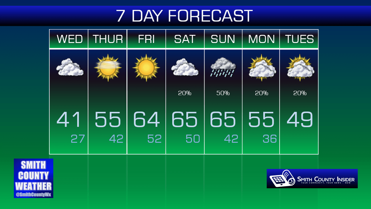
Thursday — The beginning of a nice warming trend. Mostly sunny. Wake up: 27°, High: 55°. Winds SSW at 5 to 10 mph.
Winds will begin kicking up from more of a southerly direction tomorrow, allowing much warmer air to filter into the area.
Heading into Friday, temperatures will really begin to crank up, with highs in the mid 60s through the weekend! Unfortunately, rain on Sunday will dampen any outdoor plans you may have, but Saturday is looking okay, at least right now.

Cooler temps will return next week.
Extended: