Tuesday, March 22, 2016 — 9:12 AM
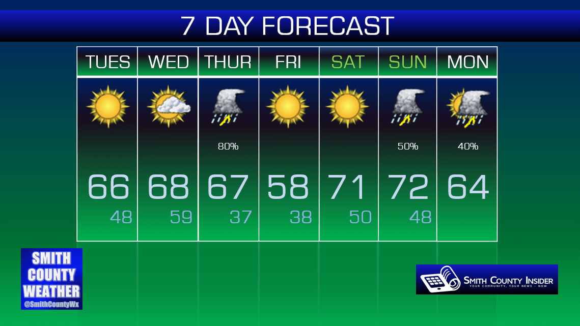
The past few days saw a return to winter. Yuck. Today, we end that trend and resume spring. Yay!

This Afternoon — Sunny. Windy. Warmer. High: 66°. Winds SSW at 10 to 15 mph.
There was a Fire Weather Watch (yes, that is a thing) in effect for this afternoon, but it has been cancelled because we no longer meet all of the requirements needed for it to be in effect. However, with very dry conditions and gusty winds, there still exists a hazard for fires to become out of control should one initiate, so simply put: don’t burn anything outdoors today.


Wednesday — Partly sunny. Wake up: 48°, High: 68°. Winds SSW at 15 to 20 mph.
Clouds will be on the increase tomorrow ahead of our next storm system. Winds will also be gusty again, so once more: avoid burning stuff.
GFS — Thursday:

Storm Prediction Center Day 3 Outlook:
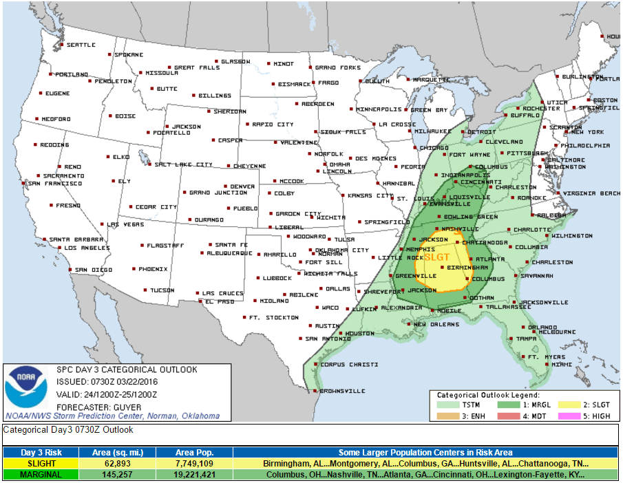
We have a Marginal Risk for severe weather on Thursday.
A low pressure system passing well to our north over Michigan will drive a strong cold front through our area, briefly cooling us back down into the 50s on Friday. It appears storms will move through sometime during the day on Thursday. Damaging winds appear to be our main concern, albeit a marginal one (hence the ‘Marginal’ Risk). We’ll keep any eye on this and post more details as we get closer to the event as they become available.
Good Friday is looking cool, but nice. We’ll warm up into the low 70s on Saturday with sunny skies, however, thunderstorms will enter the forecast on Easter. Womp…

Extended: