Thursday, January 28th, 2016 — 1:00 PM
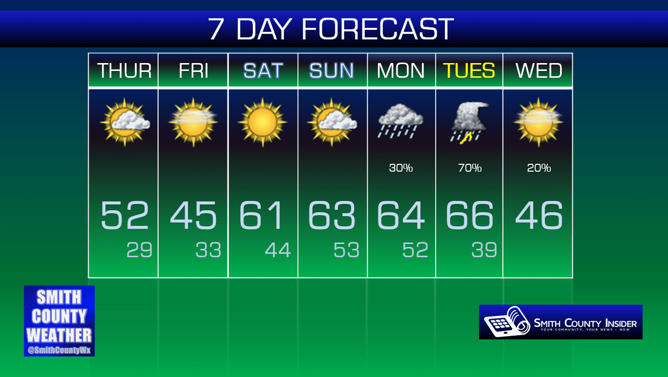
This Afternoon — Partly sunny skies. High: 52°. Winds WSW at 5 to 10 mph.
Amazingly, there are still several back roads throughout the county with some treacherous spots from last Friday/Saturday’s massive snow event. Hopefully we can finally melt the rest of that mess away today with a little sun and a high nearly 20° above freezing!

Friday — Mostly sunny. Wake up: 29°, Afternoon high: 45°. Winds NW at 5 mph, becoming calm.
Temperatures will back off slightly tomorrow to around our seasonal average, but overall, it looks to be a pretty nice day.
This weekend, we’ll really begin to warm up. How do high temperatures in the low 60s sound? It’s a far cry from last weekend’s snow, that’s for sure!
Mild temperatures will continue into the beginning of next week, but there’s a catch. There’s always one when the weather is perfect for a few days, it seems…
Storm Prediction Center ‘Day 6’ Severe Weather Outlook:
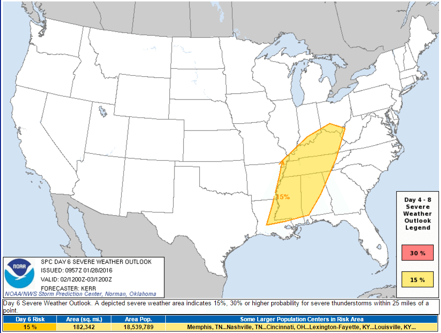
The Storm Prediction Center has issued a 15% risk area for severe weather potential on Tuesday that includes most of Alabama, Kentucky, Mississippi, and Tennessee — including us. It’s somewhat rare that they issue an outlook like this so far out, although it’s not unprecedented. It’s certainly a day we’ll be keeping an eye on, but for now, we won’t discuss possible timings or what modes of severe weather to be concerned about, because this is a long time from now, and so much can change with what models ‘think’ will happen. We’ll provide more details over the coming days, so stay tuned.
Extended: