


Tuesday, April 5, 2016 — 1:12 pm
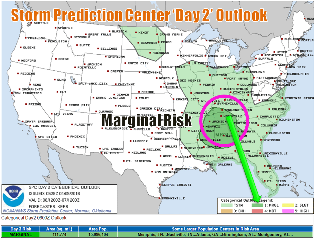
We have a Marginal Risk for severe weather Wednesday.
This isn’t the most impressive setup by any means, but as with any severe risk, we’ll certainly keep an eye on things.
A cold front moving through late Wednesday will stir things up ahead of it. It looks like a line of showers and thunderstorms will move through around sunset (time is subject to change).
Much of tomorrow will be dry, with clouds increasing during the afternoon as the cold front approaches and a high topping out in the mid 60s.
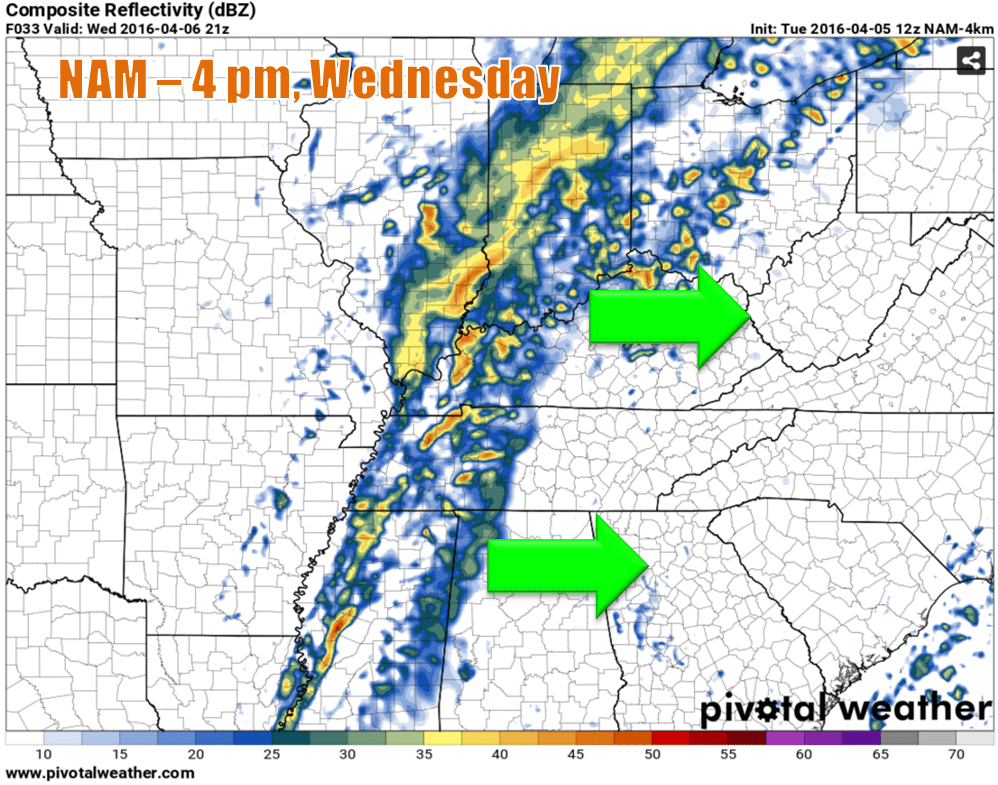
The NAM 4 model develops thunderstorms ahead of the cold front over West Tennessee tomorrow afternoon. Showers will already be ongoing ahead of the front in the morning as it progresses eastward, but as the front approaches a warmer and more storm-friendly environment, that will allow more activity to flare. Not all of the ingredients needed for big time severe weather will be in place, however — the biggest of those being CAPE (convective available potential energy), or the stuff that fuels storms. There might be a little CAPE, but not nearly to the levels where we would begin to worry. However, it does appear that there might be sufficient wind shear in place to produce damaging wind gusts, and it’s not totally out of the question that a storm could rotate and put down a brief tornado. The tornado threat tomorrow appears minimal, at best, but even with limited CAPE, it’s still not impossible for one to form given the level of wind shear present. Large hail will also be a possibility, as well.
But, and as the case with all of the above threats listed, the chances of us seeing any of those things is at the low end of the spectrum. We only have a 5% chance (right now) of seeing any type of severe weather within a 25 mile radius. That’s about as low as it gets. That doesn’t mean you should ignore it, though. Stay weather-aware, as always.
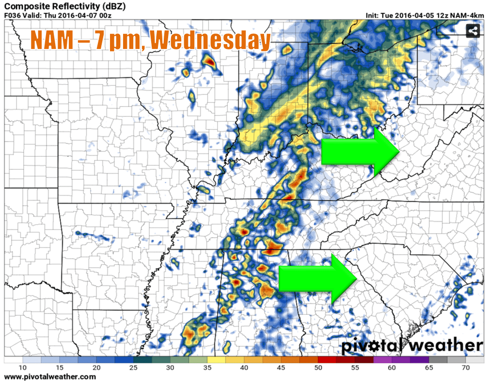
The NAM 4 has the line moving through around sunset. That’s not a definitive time frame, however, but sometime during the evening looks to be our best bet for rain and storms.
Coaches (or concerned parents who stay in close touch with coaches during these situations): if you have a ball game or practice/scrimmage scheduled for Wednesday evening, you may not have to cancel it just yet, as it’s possible the line could come through either earlier in the afternoon or later at night, but be ready to make the call to parents and or team members, because it looks likely that you won’t be able to proceed. Smith County Weather will have new updates posted throughout the day, so if you need to make a judgement call, checking out said updates will probably be a good place to start.
Behind the cold front, we won’t cool off much. Temperatures Thursday will be very much like today, but with more clouds and a very slim chance of a shower. Friday, we begin to cool down more, and by Saturday…

Not literally, of course, but our temperatures will be more typical of mid-February. But just for a day, though. Sunday will be mild again!
Also of note: we look to drop to or even below freezing both Friday and Saturday nights, so be sure to cover up those sensitive plants that you should have waited a little longer to plant but we’re too impatient to!
Extended:


