Tuesday, January 5th, 2016 — 1:27 PM
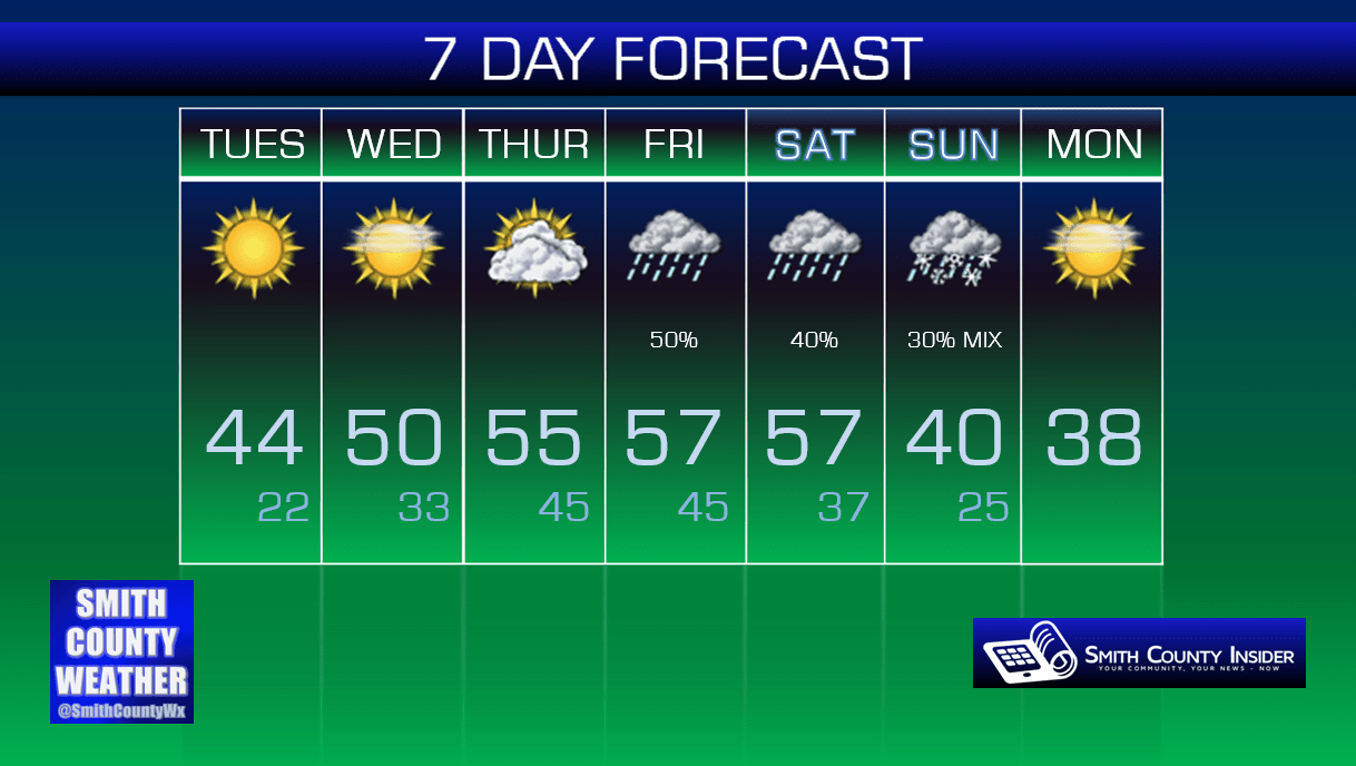
This Afternoon — Sunny skies. High: 44°. Winds ESE at 5 mph.
Winds are shifting from the North to out of the East and South, allowing our temperatures over the next several days to warm back up to above seasonal levels, although not nearly to the point we were at just a couple of weeks ago.
Wednesday — Mostly sunny. A bit warmer. Wake up: 22°, Afternoon high: 50°. Winds SE at 5 mph.
Despite another frigid start in the low 20s tomorrow morning, temperatures will rise nearly 30 degrees to near 50° by the afternoon under a mostly sunny sky.
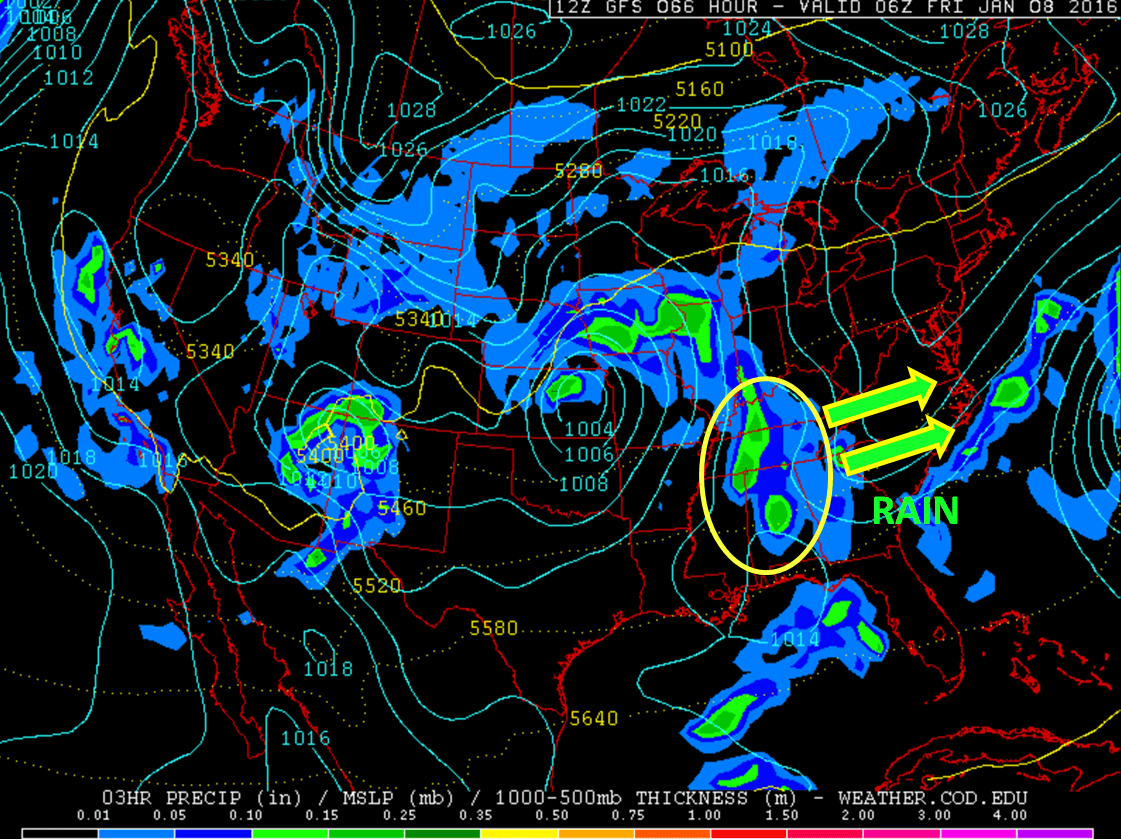
Clouds will begin to thicken up during the afternoon and evening as the area of high pressure that’s been dominating our weather over the past few days begins to push east of us, allowing for a more unsettled weather pattern to kick in. Showers will be likely Thursday night and into Friday morning, as shown in the GFS model run below.
GFS — Late Thursday Night/Early Friday Morning:
Looking ahead, more rain is appearing possible Saturday afternoon, with isolated to scattered showers perhaps lasting into the day on Sunday. At this time, it appears *possible* that there *could* be enough moisture in place with colder temperatures infiltrating the area that we could see a light rain/snow mix. This is important to note: at this time, it does not appear that we are, by any means, looking at an accumulating snow event. In fact, it may not even snow. This is an event that is many days out with a ton of variables at play, and we’re just giving you what little info we have in the most cautious way possible. Your crap app will probably show snow that day, and we want to give you as many details as we can before you take that as gospel truth. Things can change, and we’ll let you know if they do. Right now, Sunday isn’t looking like a classic snow day and isn’t worth your immediate attention.

Extended: