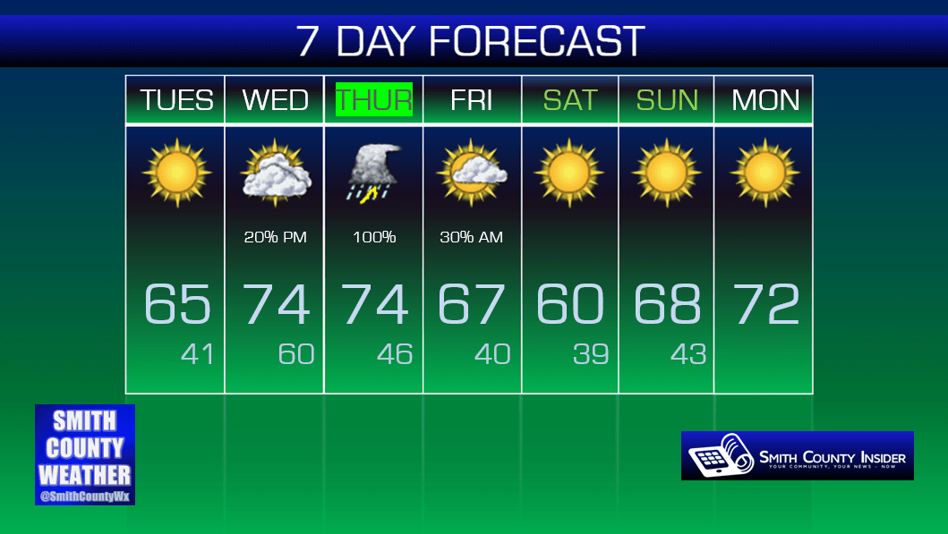
Tuesday, March 29, 2016 — 12:15 pm
This Afternoon — Sunny. Mild. High: 65°. Winds NE at 5 to 10 mph.
Tough to complain about today’s phenomenal weather. Get out and enjoy it!

Skies will remain clear overnight, allowing temperatures to fall rather quickly this evening. If you have a ball game or practice scheduled this evening, especially if it goes past sunset, you’ll probably want a jacket. We’ll drop down to near 40° by tomorrow morning.
Wednesday — Increasing clouds. Warmer. Wake up: 41°, High: 74°. Winds S at 10 to 20 mph.
Clouds will be on the increase throughout the day tomorrow ahead of our next storm system that will begin to make its way in overnight and into Thursday. Winds will also be gusting pretty strong, as high as 30 mph at times out of the South — which will help push our temperatures up into the mid 70s for our high. Not a great hair day.


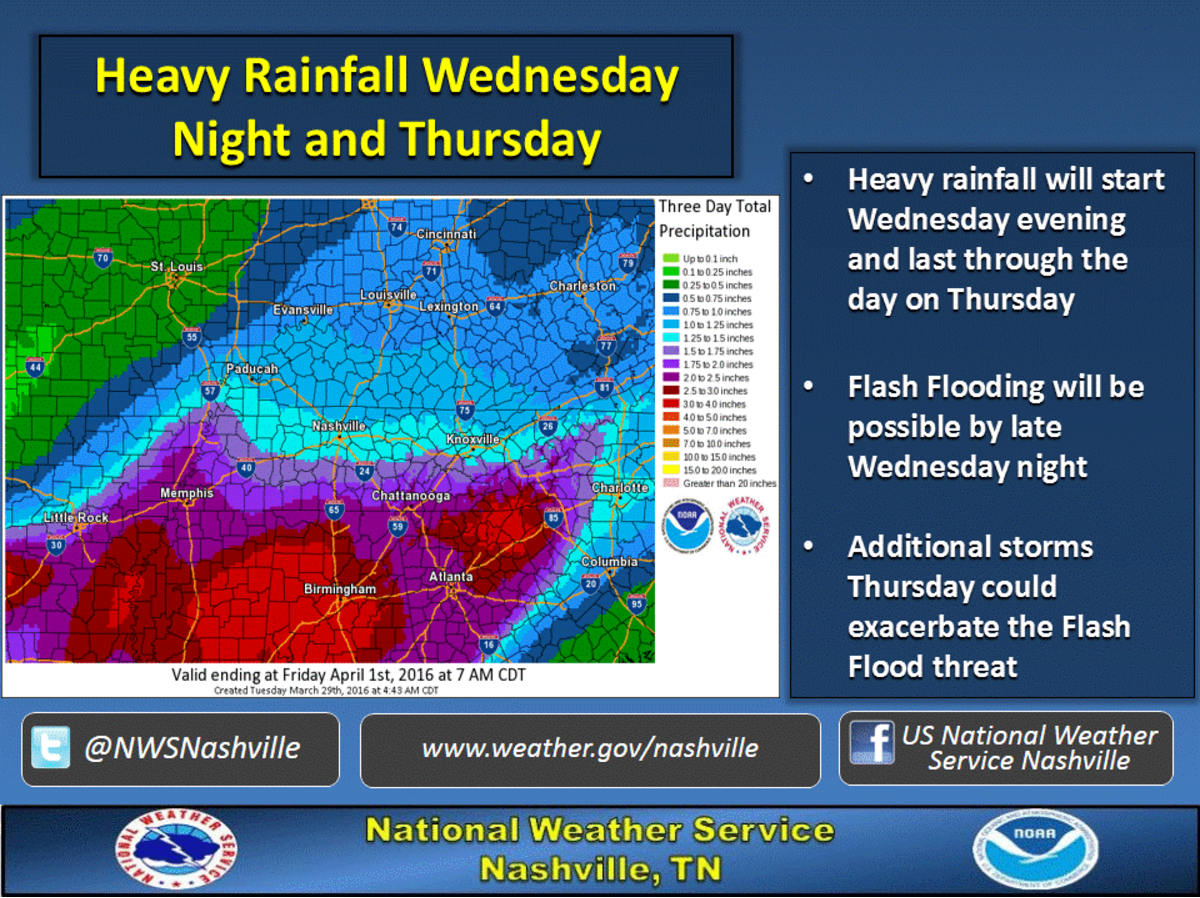

Overnight, showers and thunderstorms will begin to move in from the west. Rain will likely be heavy at times, potentially creating flash flooding concerns — just in time for our morning commute. Be very careful on your way into work Thursday morning and watch for ponding of water on roadways.
The potential for flash flooding will carry into the day and evening on Thursday. There’s an additional threat that may emerge Thursday, as well…
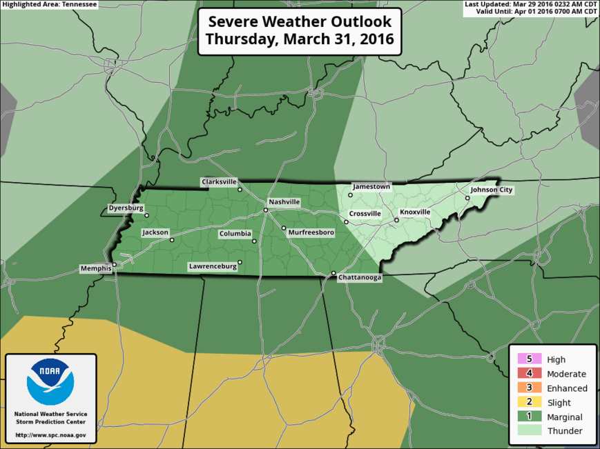
In their Day 3 Outlook, the Storm Prediction Center has placed our area and most of Middle Tennessee in a Marginal Risk for severe weather.
Thursday afternoon and evening will need to be watched carefully. There are several uncertainties that exist with this forecast — the biggest being when the morning rain showers move out and whether we have a prolonged period where we’re dry.
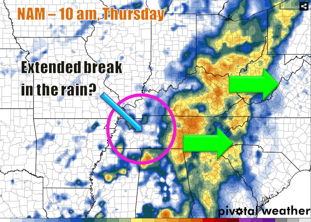
Models suggest that many of the ingredients needed for severe weather could possibly be in place Thursday afternoon and evening. Whether or not anything significant materializes will hinge greatly on how long that first round of rain lingers around and associated cloud cover, among other factors (sufficient CAPE, wind shear, etc).
Because so much uncertainty exists, SPC has gone with a Marginal severe weather risk for now. That could certainly change, but for now, y’all don’t have to be too concerned. However, pay attention to the forecasts over the next 48 hours, especially with newer model data coming in. Once we’re close enough for the short range models to give us their take on what will happen, we’ll have a better idea of how things may shape up.
As far as timing goes, we’re expecting that first round of rain and storms beginning late Wednesday night and coming to an end sometime on Thursday, possibly during the morning. More showers and storms will follow later in the day, but we’re not certain about timing. Again, if there’s a long break between rounds of storms, we’ll have reason to be concerned about severe weather. Showers and storms could possibly linger all the way up into the early morning hours of Friday before a cold front pushes everything out.
Although we aren’t very certain right now about severe weather, we are concerned about flash flooding with all the rain, as stated a few paragraphs up. We could see anywhere from 1 to 2 inches of rain before all is said and done.
Stay tuned for new updates over the next couple of days. The Smith County Weather Facebook and Twitter pages will be excellent resources as we get closer to this event and especially as it plays out, so be sure to follow along!
Extended: