Saturday, February 13th, 2016 — 8:44PM
SMITH COUNTY WEATHER ALERT: A Winter Weather Advisory is in effect from 12 PM Sunday through 6 AM Monday. Details below.
Well, here we ago again. We have yet another round of winter weather knocking on our door. Fortunately, any impacts should be short-lived, but still…snow.

We asked how you felt about the prospect of more snow on Twitter earlier this afternoon. Here are the results:
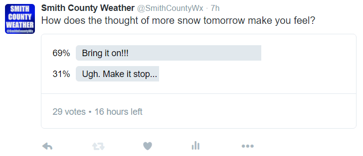
Surprisingly, it seems most of you haven’t quite had enough snow yet this season. Will this be the snow event that finally satisfies your appetite? Stay tuned.
Models finally seem to be getting a pretty good hold on tomorrow’s shenanigans, so we’re going to take a tour of a few.
THE GFS…
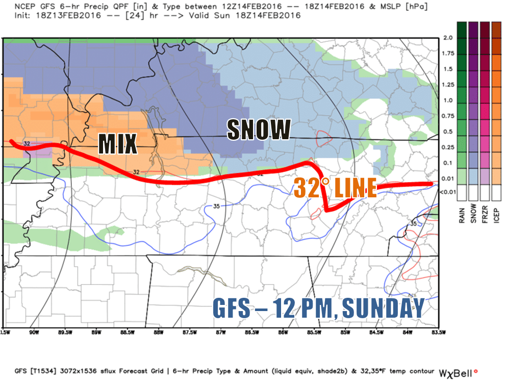


The GFS has precipitation entering Smith County around noon in the form of snow. Snow will persist through the afternoon hours until at least sunset. At that point, temperatures will begin to rise, transitioning our precipitation to first a wintry mix of rain, sleet and snow, and then to all rain late in the evening, before midnight.


THE NAM 4km…
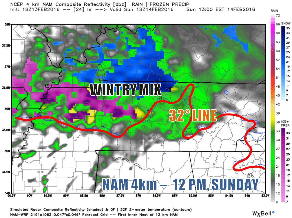
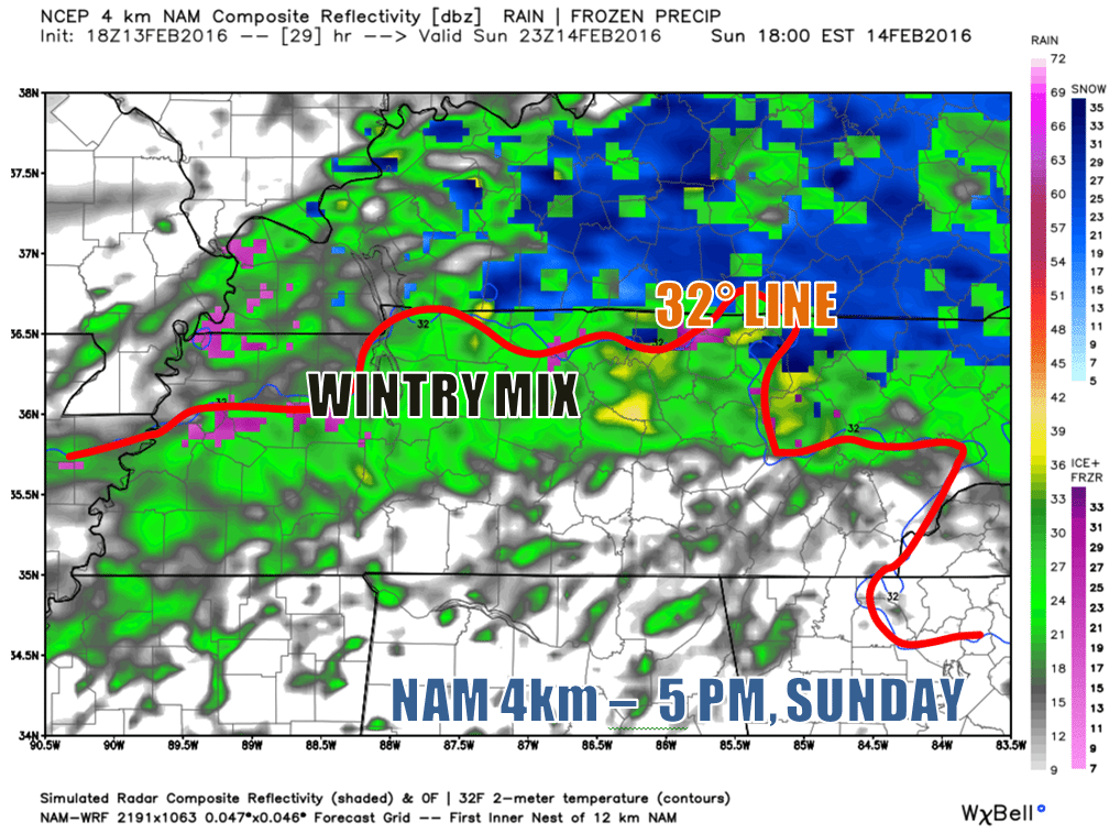
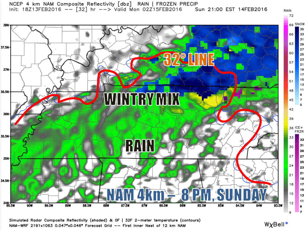
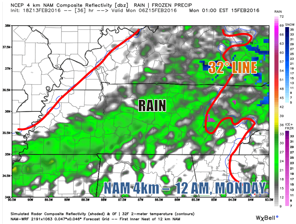
Like the GFS, the NAM 4km has precipitation beginning around noon, perhaps an hour or two sooner. Interestingly, this model wants to project a wintry mix of freezing rain, sleet and snow for the early afternoon hours, with rain (temps will be above freezing, so it won’t freeze), sleet and snow continuing through the evening before transitioning over to all rain by 9 or 10. We’re not so sure about this model. Snow would seem most probable during the daylight hours, but we shall see.
THE EURO…
We can’t show you this model for legal reasons, but long story short, it shows snow beginning in the afternoon, transitioning to rain by night. Similar story to the other two models.
So, what should we make of these models?
We can probably bank on wintry precipitation beginning around noon, give or take a couple of hours. Snow seems to be the most likely mode of precipitation that we’ll start out with, lasting through at least sunset, but it’s possible we could see a mixed bag, with perhaps a little bit of freezing rain in there — though not enough to cause any significant problems. If it’s all snow through sunset, a transition to a wintry mix would occur sometime thereafter, with everything changing over to plain ole rain just before midnight.
How much snow are we talking?
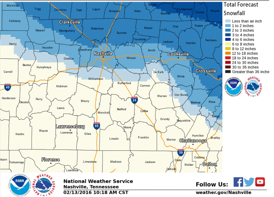
The National Weather Service has much of our county receiving anywhere from 1 to 2 inches, with areas near Macon County possibly seeing as much as 3 inches.
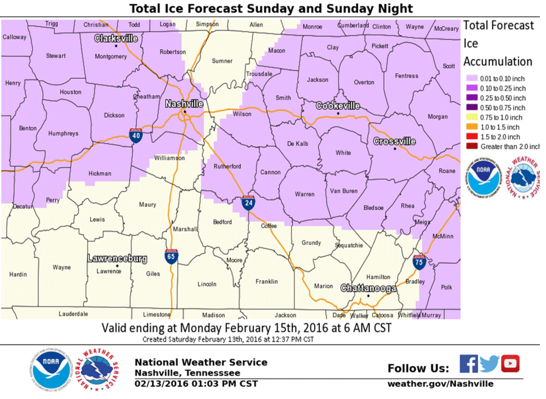
There’s also a possibility of freezing rain, with ice accumulation of up to a tenth of an inch possible. That’s not enough to bring down tree limbs or power lines, but it could add a thin, extra glaze to already snow-covered bridges.
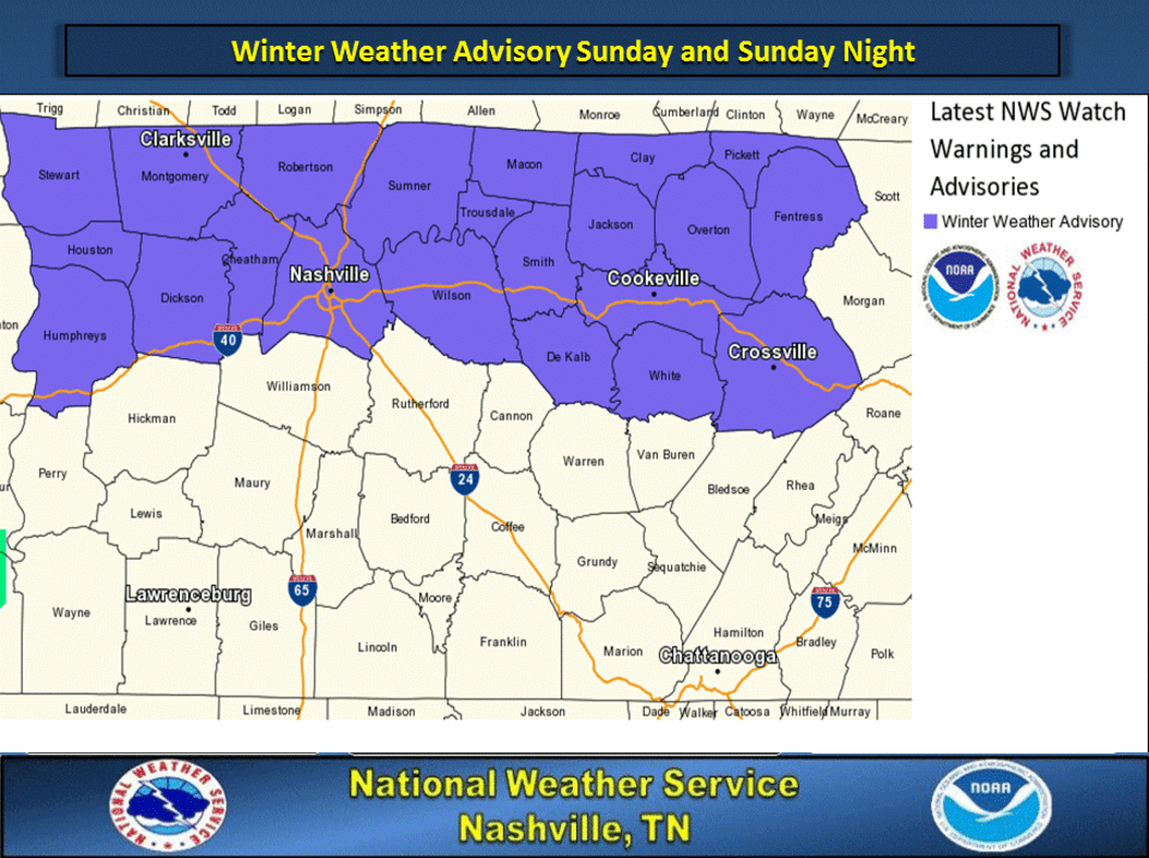
As stated near the top of the page, a Winter Weather Advisory is in effect between noon Sunday and 6 AM Monday. This advisory is for the possibility of accumulating snow over an inch and that slight ice potential we just mentioned — both of which could create travel issues during the advisory period.
So, how long will it take for the snow to melt?
Probably not long. Again, we’re expecting any wintry precipitation to have changed over to rain by midnight Sunday, with rain showers continuing through much of the day on Monday. The less snow we get, the less time it will take for it all to melt away. It’s probably a safe bet that most, if not all, accumulated snow will be gone by daylight Monday morning. Snow and water just don’t really get along all that well. With temperatures rising into the mid 40s during the afternoon on Monday, any persistent ‘slush’ lingering around won’t be able to stand a chance.
Still, just because our problems won’t last long doesn’t mean there won’t be problems. Roads could be treacherous for a good part of tomorrow afternoon and evening, so use exercise plenty of caution if you have plans to be out and about for Valentine’s Day. Hopefully with temperatures in the evening being slightly above freezing, main roads at the very least should be okay. Back roads could be a problem until the rain begins, though, so keep that in mind.
We’ll be posting updates throughout the day on the Smith County Weather page, so follow along on Facebook and Twitter!
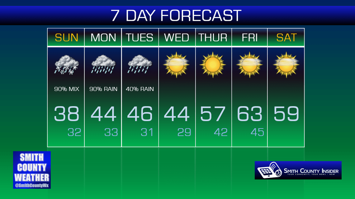
Beyond Monday, highs will remain in the upper 40s through the middle of the week, with a big warm up coming by the weekend!
Extended: