Monday, February 8th, 2016 — 10:57 PM
SMITH COUNTY WEATHER ALERTS (2):
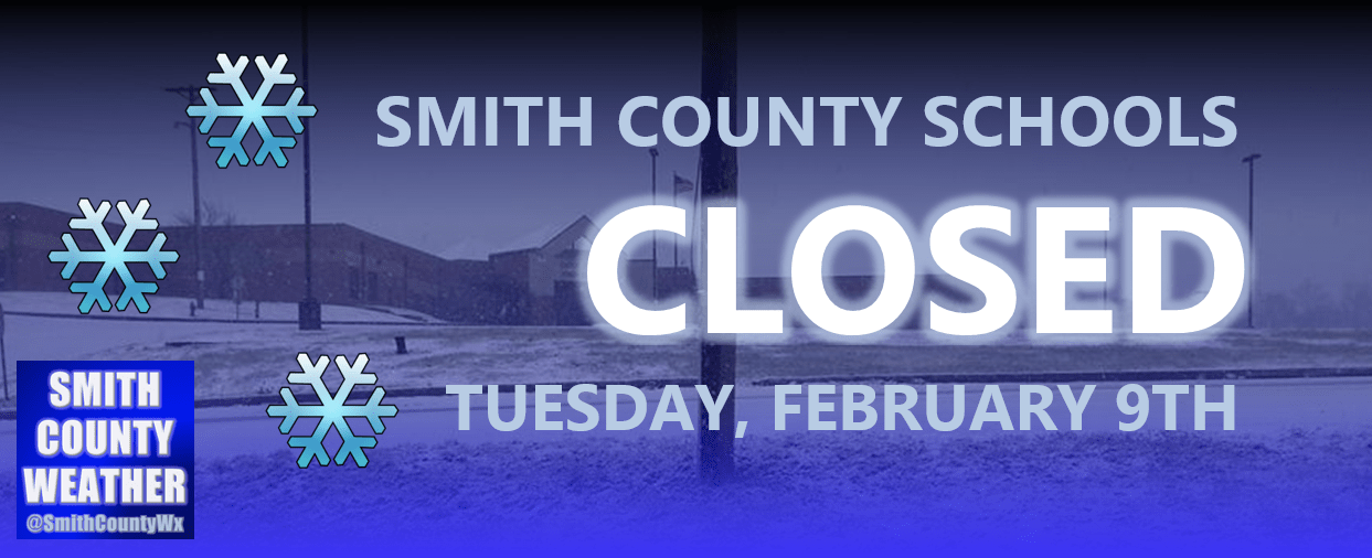
(1) SMITH COUNTY SCHOOLS ARE CLOSED TUESDAY, FEBRUARY 9TH
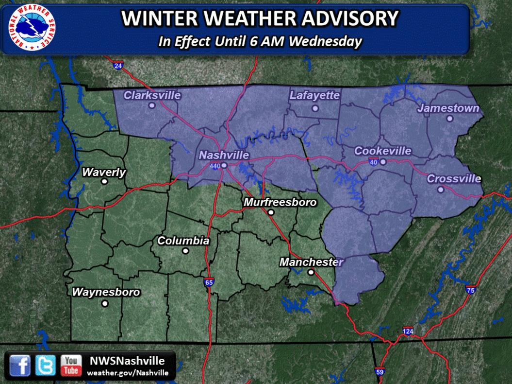
(2) a WINTER WEATHER ADVISORY is in effect through 6 AM, Wednesday


On and off scattered snow showers and flurries will continue to stream into our area overnight and through the day tomorrow, slightly diminishing in coverage and intensity with time.
HRRR through 11 AM, Tuesday:

As was the case earlier, HRRR might be under-doing the coverage of snow showers just a little bit, but in general, we aren’t expecting a widespread snow event as we head into the day tomorrow.
NWS Snowfall Totals Map (through Wednesday):
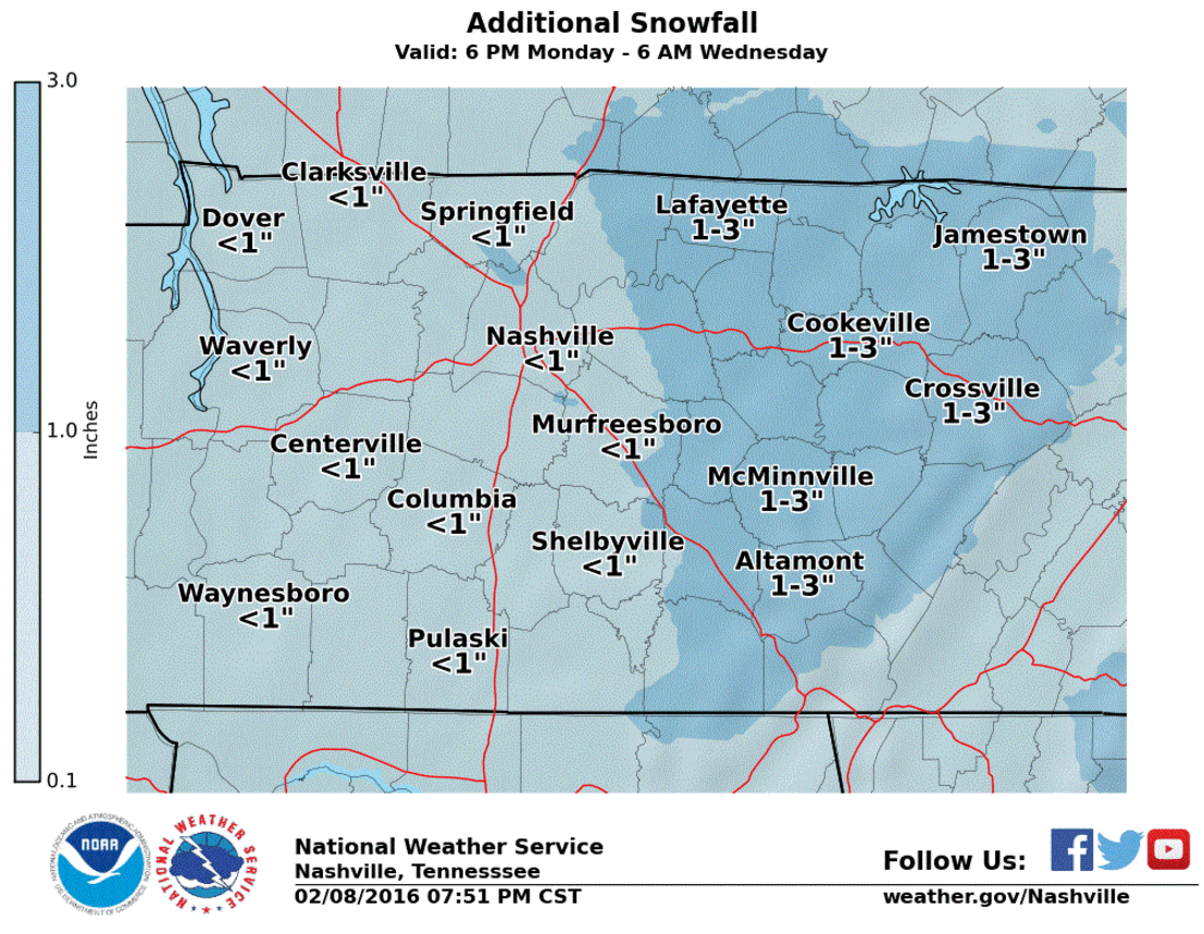
The National Weather Service has upped their projected snowfall accumulations for our area. We were previously looking at an inch of snow or less. Now, it looks like we could see anywhere from 1 to 2 inches, with pockets of up to 3 inches not out of the realm of possibility, especially in higher elevations. A Winter Weather Advisory is in effect through Wednesday morning at 6 AM. Accumulating snow through the day tomorrow combined with temperatures below freezing will allow for prolonged travel hazards, especially on secondary roads that weren’t treated. Use plenty of caution if you have to be out and about.
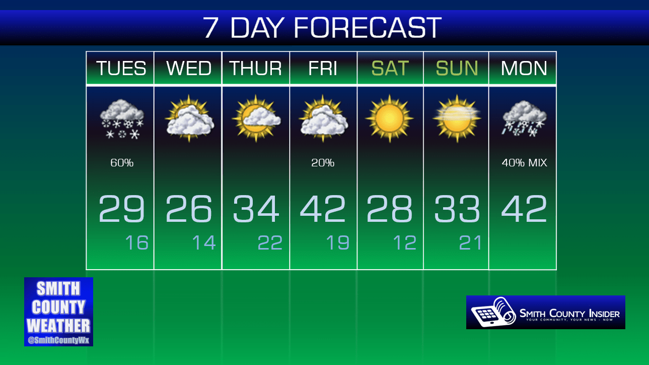
We’ll begin to dry out Tuesday evening, only for a long period of frigid days to settle in!
Extended: