


Saturday, December 26th, 2015
We hope you enjoyed your Christmas!

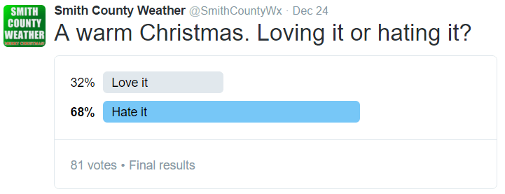
The warm weather probably didn’t help your Christmas spirit much. In fact, when asked on Twitter, 68% of respondents said that they “hated” the warm weather, and that’s out of 81 people who answered.
Well, we have good news and bad news for those of you who don’t like the warmth. The bad news: this weekend may break some records, temperature-wise. The good news? By the time we ring in 2016 next week, temperatures will be back down to where they are supposed to be. Be patient.
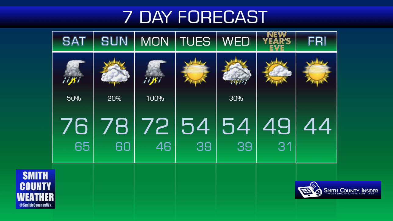
Today — A shower or thunderstorm possible this morning; cloudy and very warm in the afternoon. High: 76°. Winds S at 5 mph.
A cold front came through yesterday, giving us showers and thunderstorms through much of our Christmas Day, especially in areas in the southern half of the county. Today, that front has come back north as a warm front, giving us yet another chance for showers and storms this morning. We could see a shower or thunderstorm before noon, with dry conditions this afternoon and temperatures feeling like the middle of May.
Sunday — Mainly dry. Crazy warm. Wake up: 65°, Afternoon high: 78°. Winds S at 5 to 10 mph.
This is no exaggeration: our Sunday may feel like early June, with dewpoints in the 60s and a high in the upper 70s. Heck, we’ll start out the day in the mid 60s. That’s our average low in mid June. Aside from the insanely warm temperatures, we look to remain dry throughout the day.
Of course, this warmth will have to come to an end. We’re expecting a sharp cold front to move through on Monday, setting the stage for another round of showers and storms. We’ll have to watch for more severe weather potential that day. Once the front passes, our temperatures will finally return back to the way they are supposed to be.
Extended:
This post is brought to you by Smith County Weather. You can ‘LIKE’ Smith County Weather on Facebook and/or follow @SmithCountyWx on Twitter for the latest weather updates pertaining to Smith County, TN.


