


Tuesday, December 22nd, 2015 — 11:51 AM
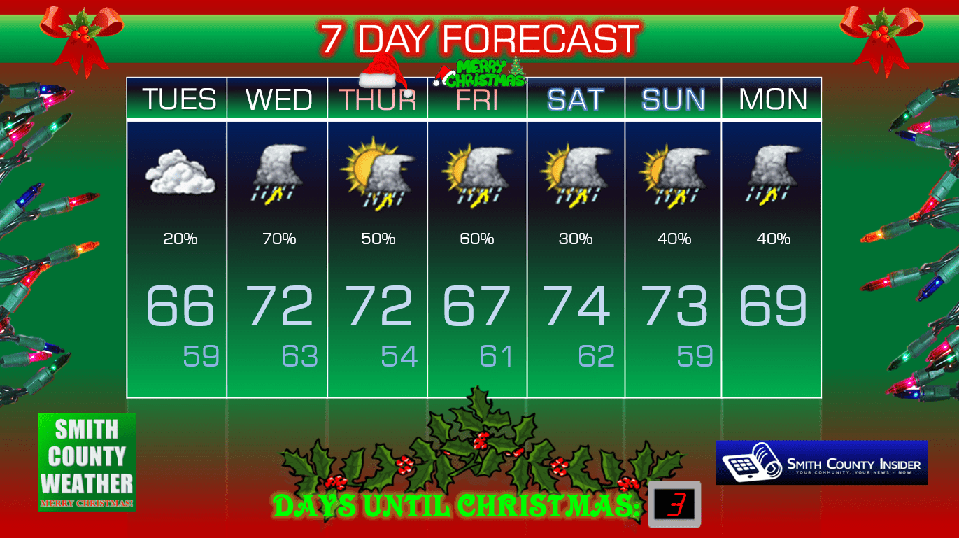
This Afternoon — Cloudy. High: 66°. Winds SSE at 5 mph.
Another unseasonably warm air pattern kicked off yesterday that will really ramp up today, with temperatures soaring into the mid 60s this afternoon. Temperatures by this weekend could be in the mid 70s. Amy Grant was right: there will be more snow up in Colorado than our roofs will ever see. Meanwhile in Tennessee, our tender Christmas will find many people wearing shorts and tank tops because of the warmth.

Alright, it’s time to be serious for a bit.
Models have been consistently painting a more and more ominous picture for our day on Wednesday. We’re still not to the point of total worry or panic, but a heightened level of concern should be given.
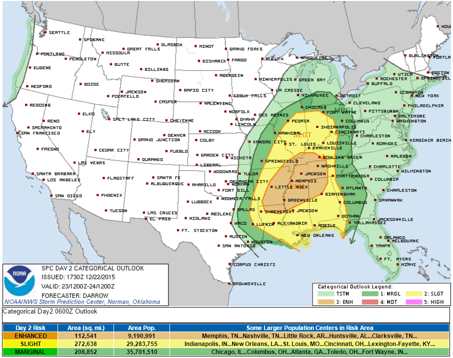
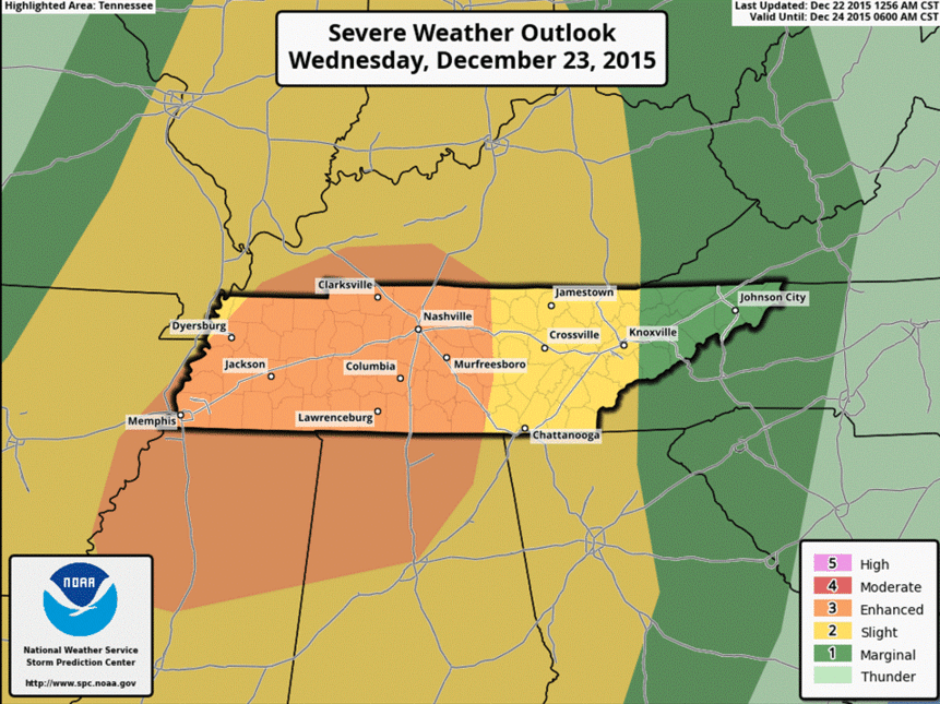
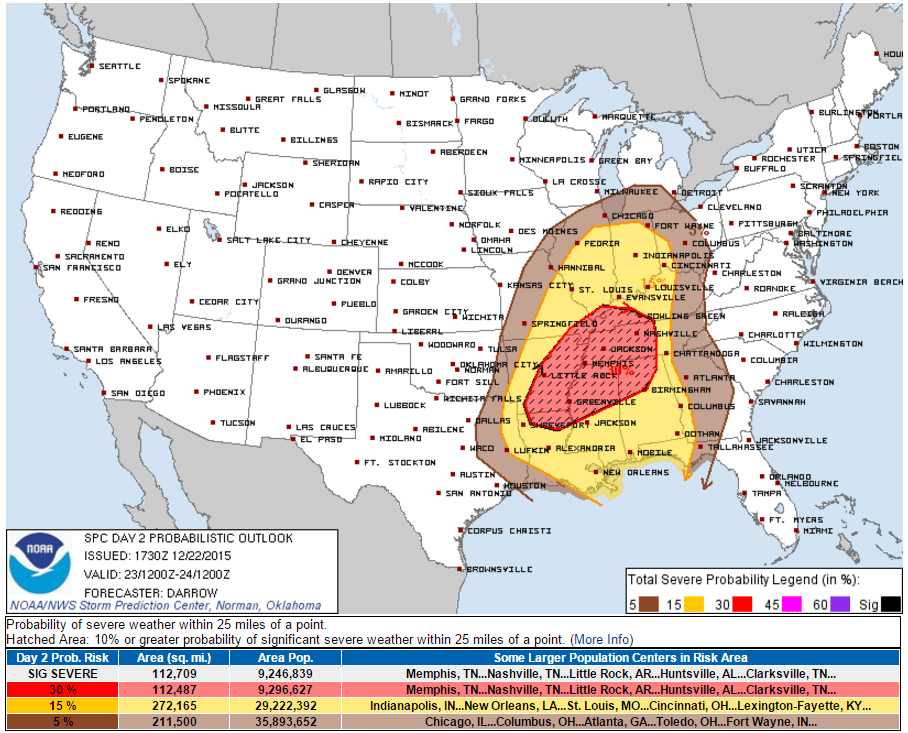
Yesterday, the Storm Prediction Center had placed us in a Marginal Risk area for severe storms, or a 1 out of 5, if you want to think of it that way. Models were indicating the potential for severe weather, but too many uncertainties existed to place us in a higher risk designation. Today, they have bumped us up to an Enhanced Risk, or a 3 out of 5, which is quite a bit more concerning. This means there is a 30% chance of severe weather (damaging winds, large hail, isolated tornadoes) occurring within 25 miles of any given point. Even more bothersome, they have placed us in a 10% ‘hatched’ area for significant severe weather, with perhaps some strong tornadoes possible.
Note: The National Weather Service is heavily avoiding referring to this as an “outbreak,” and for good reason. Rather than calling it that, they are simply pointing out that the ingredients needed for severe weather will be in place.
The good news: there isn’t much precedent for storm systems like these to point towards a guaranteed severe weather, dare we say, “outbreak.” Looking back at past events, we’ve never really had significant severe weather like what models want to suggest for tomorrow. That doesn’t mean we’re out of the woods, and there’s certainly always a first time for everything, but that’s at least a hopeful tidbit that perhaps tomorrow will end up being a dud — and we hope it will be. But again, models right now aren’t agreeing with history.
Speaking of models, let’s look at some…
HRRR – Midnight Tonight:
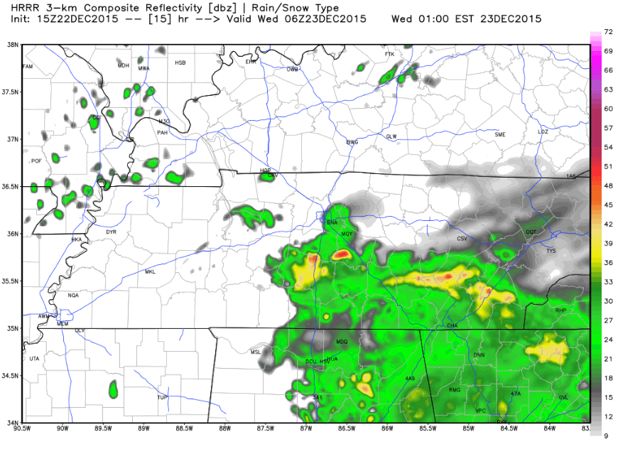
Our next round of showers and storms will move through overnight through early tomorrow morning. We’re not expecting any severe weather with this, but don’t be surprised if you hear a rumble of thunder.
NAM4 — 6 PM, Wednesday:

NAM4 — 9 PM, Wednesday:

This is a difficult system to pinpoint exact timings with. For one thing, models are suggesting the possibility of supercell thunderstorms, which can pop up at literally any time and anywhere. Those are also the ones that produce the most memorable tornadoes, not to scare any of you — although the markers we look at for potential tornado development are particularly high. Mid to late afternoon through around midnight and possibly into the early morning hours of Thursday is the time frame we are focusing on, and that’s the best we can give you right now. Severe storms could be possible at any point during that time, so be on alert throughout the day. There’s also the risk of this going into the overnight hours and spewing into early Thursday morning, so be aware of that, as well. Nocturnal tornadoes kill many people, especially here in Tennessee, and we don’t want that to happen.
It’s very important to note when discussing all of this that we are still an entire day out from all of this happening, so there is a huge margin for things to change, whether it be for the better or worse. Don’t come away from reading this thinking tomorrow will be some awful severe weather day. There are so many factors in play that if just one of them changes, our entire perspective of tomorrow could shift drastically one way or the other. One such example is the stream of gulf moisture coming up from the south. Should there be shower and storm activity along the Gulf Coast area up through parts of Alabama, that could cut off the amount of ‘juice’ storms would need to fire up, thus significantly limiting instability. Unfortunately, it’s not looking like that will happen, but there are other factors in play that could change, so know that and be smart with everything you read on the internet over the next couple of days.
Now is the time to be preparing for what tomorrow could bring. First of all, if you have plans to travel, it would probably be wise to get it done today or wait until Thursday. If you absolutely have to travel tomorrow, try to get it done in the morning. If you set out tomorrow afternoon or evening, you are doing so at your own risk. Next, make sure your cell phones are fully charged throughout the day, have a safe place ready to go to in the event that a warning is issued, and have a way of getting weather alerts, whether it be via a NOAA Weather Radio or through a smartphone app. We’ll be posting updates throughout the day and night (if necessary) on the Smith County Weather pages on Facebook and Twitter (@SmithCountyWx), so follow along with those pages for up-to-the-minute severe weather information. All that will be posted here will be the forecast info such as this, so keep that in mind. Live updates will ONLY be posted on the aforementioned social media pages.
Extended:
This post is brought to you by Smith County Weather. You can ‘LIKE’ Smith County Weather on Facebook and/or follow @SmithCountyWx on Twitter for the latest weather updates pertaining to Smith County, TN.


