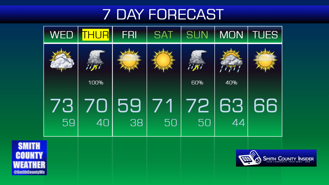
Wednesday, March 23, 2016 — 2:43 PM
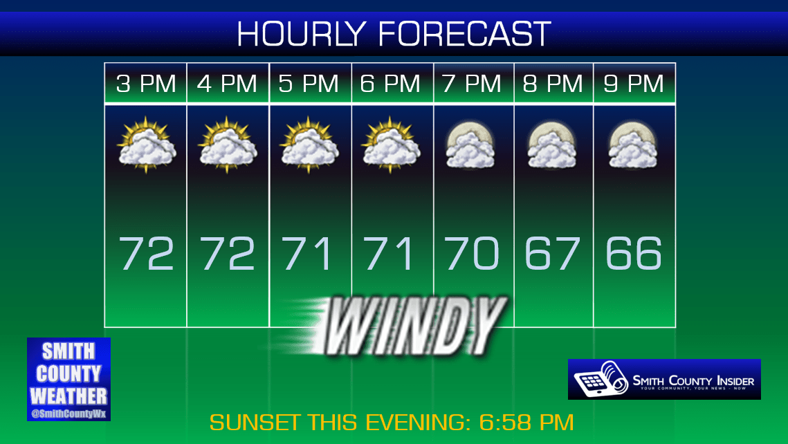
This Evening — Partly to mostly cloudy. Breezy. Temperatures in the upper 60s to around 70°. Winds SSW at 15 mph, gusting up to 30 mph.
It’s been a windy, but otherwise nice early spring day!

If you have plans to be outdoors this evening, you should be good to go. Temperatures will be comfortably mild in the upper 60s to around 70°. About the only downside will be the gusty winds.
Here’s an hour-by-hour breakdown of this evening:
Tomorrow won’t be so nice…
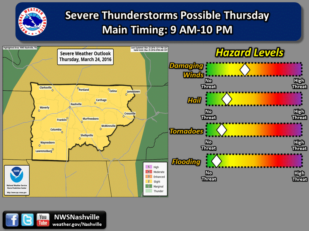
We have a Slight Risk for severe thunderstorms Thursday.


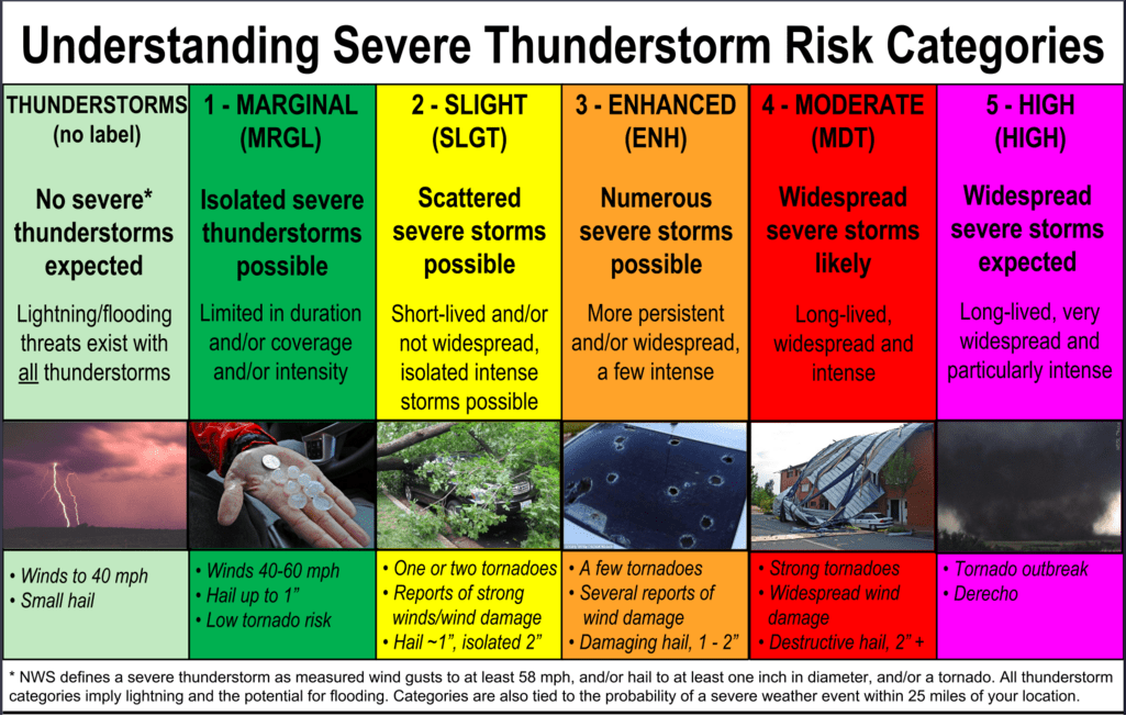
In case you need a refresher, especially now as we head into what is typically the heart of our severe weather season, the above graphic details what all of the risk categories mean. Tomorrow’s Slight Risk is essentially a ‘2’ on a scale of 1 to 5. While that is certainly not the highest level of concern, you should still remain alert throughout the day tomorrow and pay attention to watches and warnings, should any be issued.
Our main concern tomorrow is damaging winds, however, large hail and even some isolated tornadoes cannot be ruled out.
Both CAPE (convective available potential energy) and STP (Significant Tornado Parameter; a very good indicator of tornado conditions) values appear to be on the low side for tomorrow, especially the latter of those two. That doesn’t mean things can’t change, nor does it mean we’re out of the woods for significant severe weather beyond a damaging wind threat, but it’s worth pointing out.
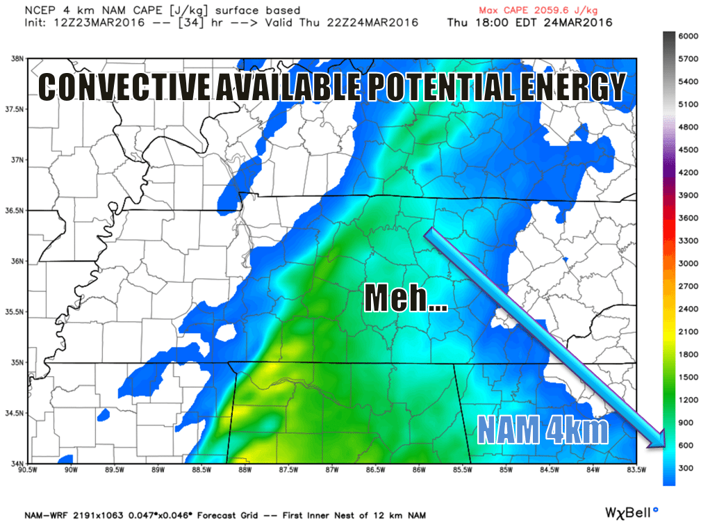
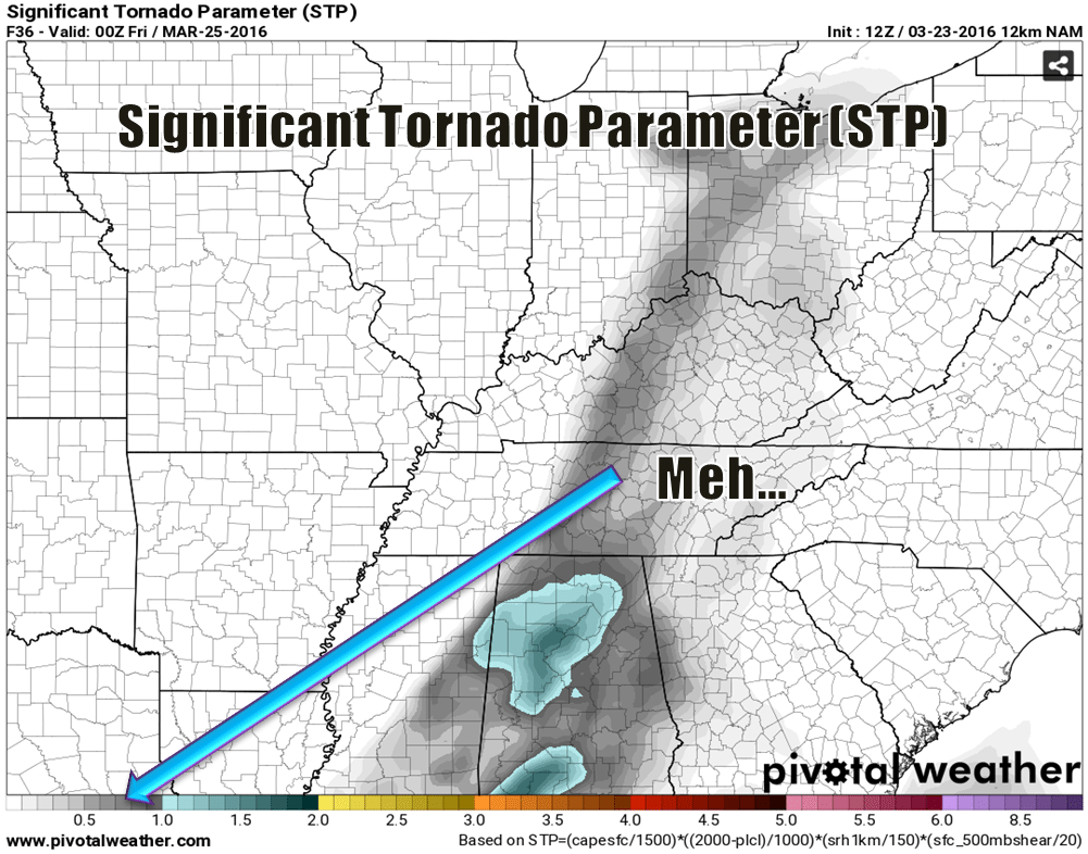
So yeah… Damaging winds will be our primary concern tomorrow with a side of large hail potential, but tornadoes don’t appear to be much of a threat. In other words: keep up with the latest Smith County Weather updates and monitor several other trusted weather sources (NOT your crap app…) for the latest information through the day tomorrow.
So, when will all of this go down, some may ask?
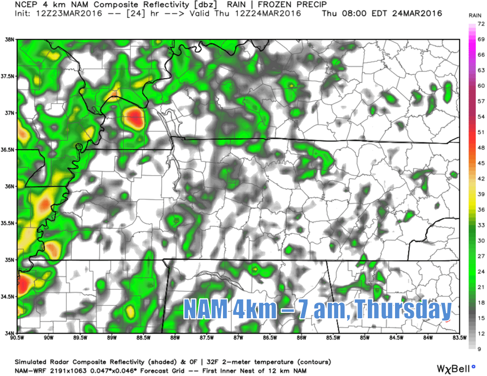
Widely scattered showers and storms could initiate as early as our morning commute tomorrow, at least according to the NAM 4km (above). If it rains a lot, that could potentially inhibit our severe storm chances later in the day. Conversely, the less it rains, or especially if it doesn’t rain at all (which is a possibility), then our severe potential could increase somewhat. It’s something we’ll keep an eye on tomorrow.
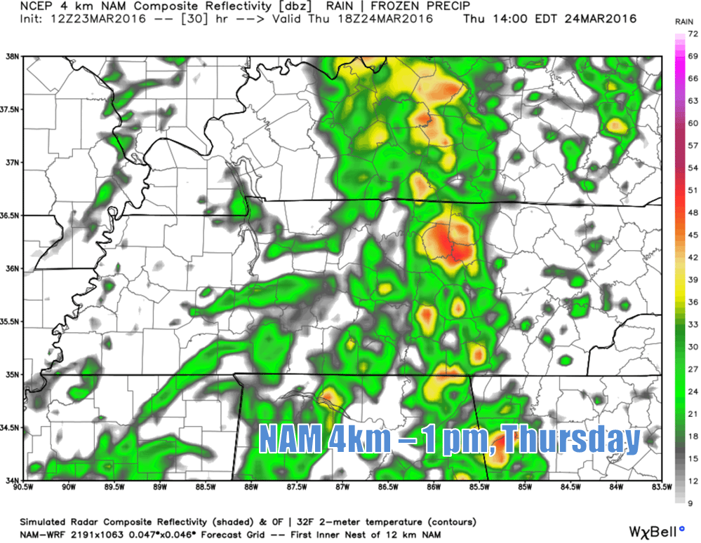
NAM 4km depicts a rather broken ‘line’ of showers and storms moving through around lunchtime. Can’t rule out severe cells within that round of storms.
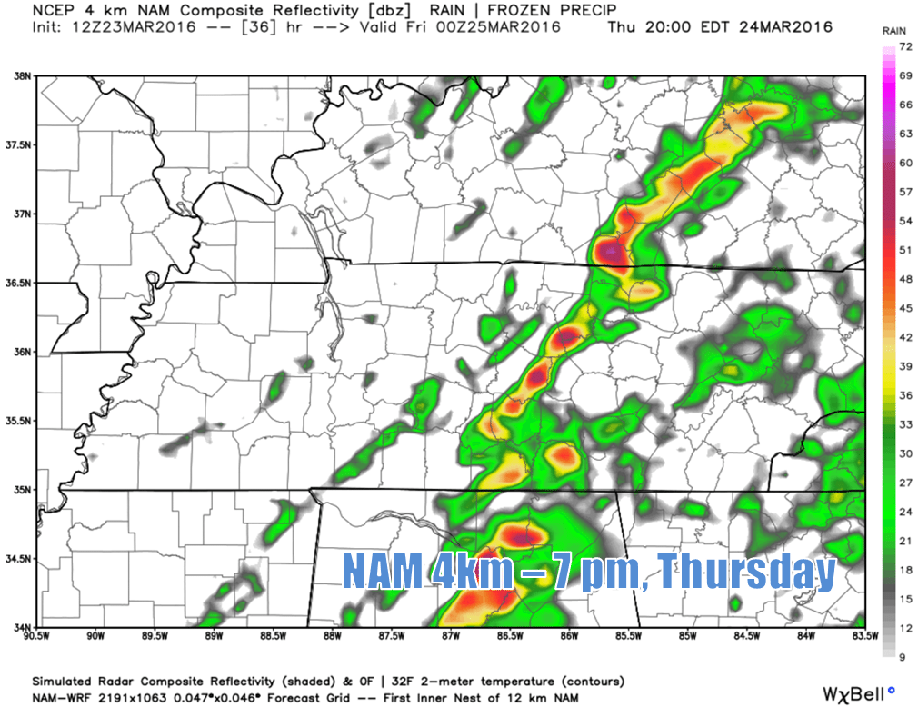
The NAM 4km shows yet another line moving through during the early evening hours as the cold front driving all of this passes through. It wants to show this round being almost like a squall line, which could certainly contain damaging winds, so we’ll have to watch that, as well.
By tomorrow night, we’ll dry out, with temperatures falling to around 40° by Friday morning. Our high on Friday probably won’t make it out of the upper 50s, even with a mostly sunny sky.
Bottom line: keep an eye to the sky tomorrow. With a couple of rounds of storms possible, our severe weather threat may not fully end until night, so pay close attention to the weather and have a way of receiving warning alerts, either through a weather radio or an app on your smartphone. Updates will be posted throughout the day on the Smith County Weather Facebook and Twitter pages, so you can always keep up with the weather that way, as well.
Many of you are probably wondering about Easter. Unfortunately, it’s looking to be on the stormy side. Have an indoor backup plan for your Easter egg hunts before/after church.
Extended: