Thursday, March 10, 2016 — 1:34 PM
We had a few showers move through early this morning. We’ve been dry since then, but more rain will move in later in the day/this evening.
HRRR loop through 2 AM Friday:

HRRR shows rain arriving around 5 PM. The NAM 4km (below) tells a similar story:

5 PM isn’t an exact ETA, but plan on showers beginning sometime late this afternoon or early this evening. We’ll see rain continue through around midnight. There may even be a few embedded lightning strikes, but we’re not expecting any severe weather.


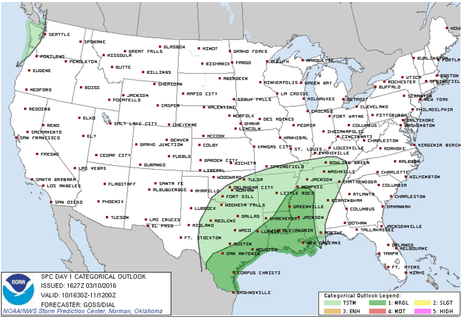
The Storm Prediction Center only has us outlined for ‘general thunderstorms’.
SPC Day 1 Outlook:
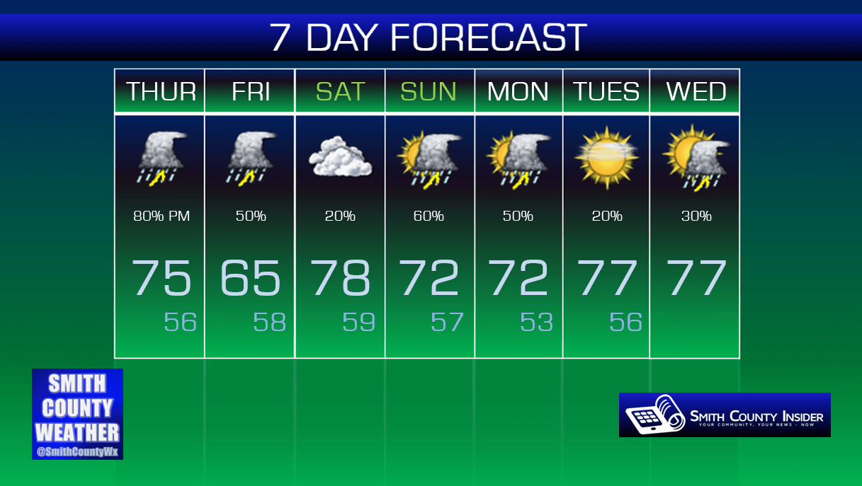
Friday — Cloudy with some widely scattered showers. A bit cooler, but still mild. Wake up: 56°, High: 65°. Winds NE at 5 mph, becoming calm.
Once the bulk of the rain moves out of here early tomorrow morning, some scattered shower activity will linger around throughout the day. It won’t be a total washout, but random showers will be possible at much any time.


Once again, we could see a few embedded thunderstorms, but no severe weather is expected.
Right now, it appears we will begin to dry out during the evening, with dry conditions continuing through at least much of the day on Saturday. If you have outdoor plans, it *appears* you will be okay, but keep an eye to the sky and check with Smith County Weather for the latest updates.
As long as we’re dry Saturday, that will also allow for our temperatures to soar back into the upper 70s.
More rain will become likely Saturday through the day on Sunday, perhaps lingering into Monday. Despite the rain, temperatures will remain well above average through at least the middle of next week!
Extended: