Wednesday, February 24, 2016 — 1:50 PM
This Afternoon: Cloudy with scattered showers increasing in coverage. Temperatures falling into the upper 30s by sunset. Winds WSW at 15 to 20 mph.
After a mainly cloudy start to our day, more showers are filtering into our area this afternoon. You’ve no doubt felt the sharp drop in temperatures from this morning. We went from feeling like spring to now back in the throes of winter! And that wind… It’s not a fun day to be outdoors.
HRRR loop through 2 AM Thursday:


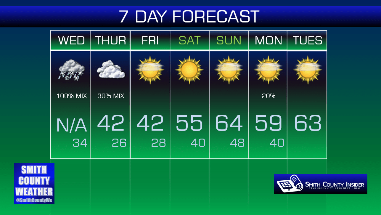
As colder air is wrapping in behind the surface low as it moves northeast of us, it’s possible some snow could begin to become mixed in with the rain this evening. With the ground well above freezing and temperatures expected to fall only to around 34° by tomorrow morning, accumulation is doubtful, even with snow showers possibly persisting through the early morning hours of Thursday.

Thursday — Cloudy. A stray shower possible. Cold. Wake up: 34°, High: 42°. Winds W at 5 to 10 mph.
NAM 4km — 1 PM Thursday:

A few isolated rain showers may linger around through the day tomorrow — with a few snow flakes mixed in not out of the question. Otherwise, it’s just going to be a bland day, with temperatures struggling to make the lower 40s for our high.
Friday will remain cold, but it will see the return of the sun.
This weekend…

See for yourself!
Extended: