


Wednesday, December 16th, 2015 — 12:53 PM
This Afternoon — Increasing clouds with showers becoming likely late. High: 67°. Winds S at 5 mph.
Showers will become likely as we head into the evening hours as a cold front approaches our area.
HRRR – 5 PM:
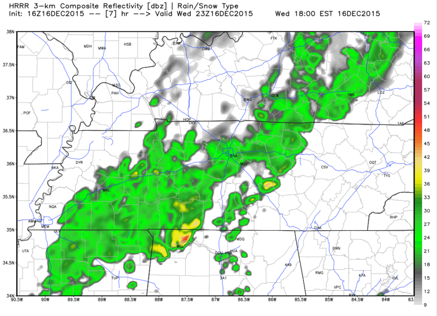
The above image is what radar may look like at 5 PM this evening, although we could possibly see some shower activity a little before then. Rain will be on and off through much of the evening before moving out early Thursday morning. Less than a half inch of rain is expected.
Once the cold front passes, winds will shift out of the northwest, making for a chilly day tomorrow.
Thursday — Decreasing clouds. Cooler. Wake up: 47°, Afternoon high: 51°. Winds NW at 5 mph.
That 51° will feel especially cool after the mild few days we’ve had. And that’s not the extent of how cold we’ll get…

Friday — Mostly cloudy and cold… Wake up: 30°, Afternoon high: 43°
You’ll want that winter coat on Friday, for sure. You’ll need it again on Saturday, but by Sunday, you’ll be asking yourself once again what time of year this is, as temperatures will climb back up to unseasonable levels — which will be with us all the way up until Christmas.

Extended:
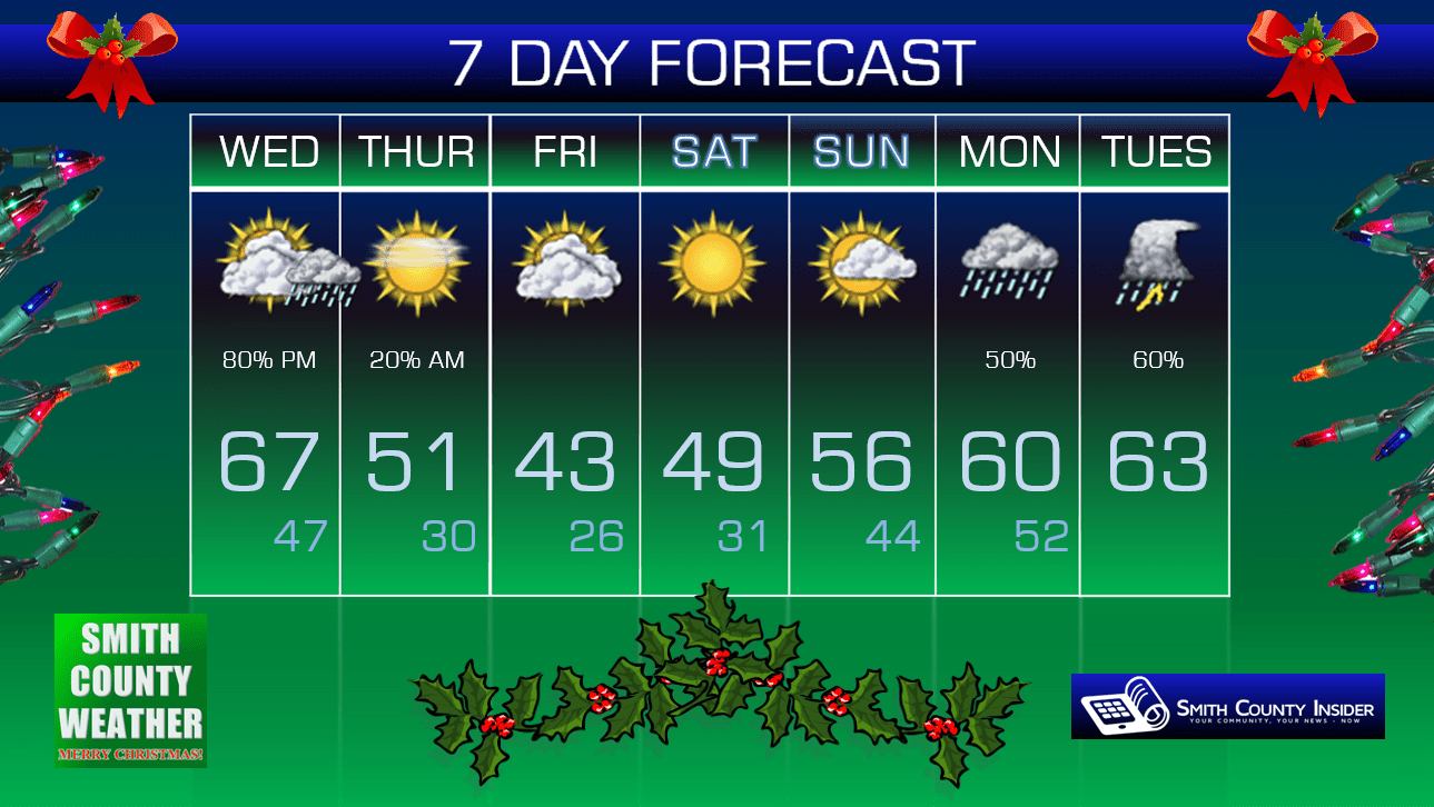
This forecast is brought to you by Smith County Weather. You can ‘LIKE’ Smith County Weather on Facebook and/or follow @SmithCountyWx on Twitter for the latest weather updates pertaining to Smith County, TN.


