Wednesday, February 10th, 2016 — 1:28 PM
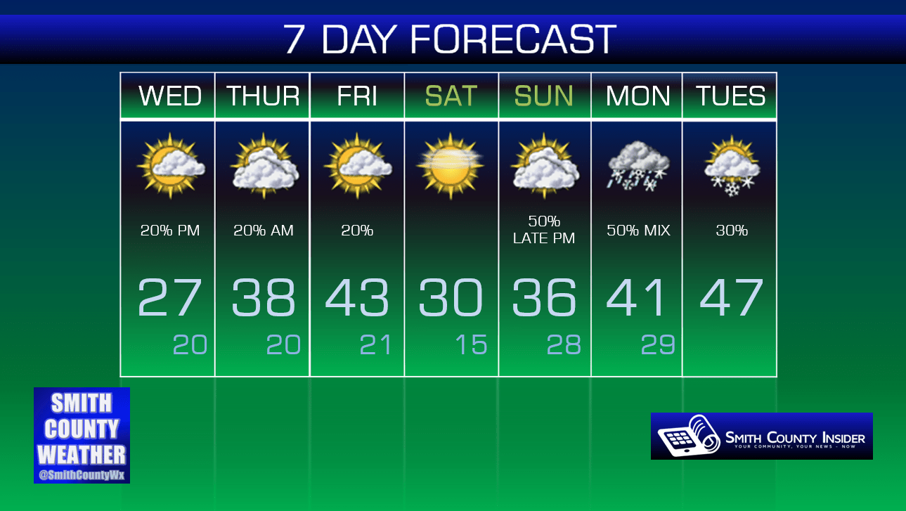
This Afternoon — Partly sunny skies. Chilly. High: 27°. Winds W at 5 to 10 mph.
We’re getting a break from the scattered light snow showers and flurries today, but with temperatures only in the upper 20s, snow-covered back roads may not see much in the way of melting.
Tonight, we could see yet another clipper system bring us a round of snow showers and flurries…
HRRR loop through 2 AM, Thursday:

The HRRR (above) seems to favor the bulk of the snow passing just to our west. The NAM 4km (below), however, has the system passing directly over us.


NAM 4km at 7 PM:

Regardless of where the system ultimately tracks, we aren’t expecting a great deal of accumulation with this.
NAM 4km total accumulations through Thursday morning:
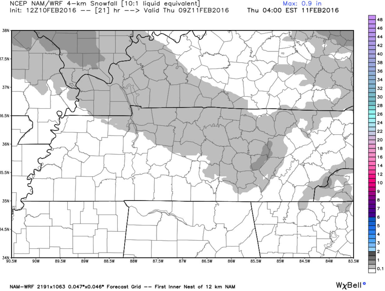
At most, we’re looking at a dusting to a half inch, if that. Perhaps enough to add to existing travel problems on some of our back roads, but not enough to warrant a Winter Weather Advisory (the one we were under was allowed to expire as scheduled at 6 AM this morning).
Thursday — Mostly cloudy. Above freezing (but still cold). Wake up: 20°, High: 38°. Winds NW at 5 to 10 mph.
We’ll rise back above freezing tomorrow afternoon with mostly cloudy skies. It will still be cold, though…

Our next *potentially* significant winter weather system looks to arrive Sunday evening, lasting through the day on Monday. It’s far too early to give specifics just yet, so pay no attention to bogus “3 to 5 inch” accumulation totals your weather crap apps may be showing. We don’t know yet what will happen, but we will have a better idea as models begin to come into agreement over the coming days, so stay tuned for future updates.
Extended: