Thursday, February 25, 2016 — 4:25 PM
This Evening — Scattered sprinkles/flurries/snow showers/sleet. Temperatures falling into to around 32° by midnight. Winds WNW at 5 to 10 mph.
HRRR loop through 5 AM Friday:

We’ve seen a mixed bag of on and off light rain, sleet and wet snow flakes today. We expect this wintry mix to continue through this evening.


There’s still quite a bit moisture remaining in the atmosphere. With temperatures falling below freezing overnight, it’s possible that any lingering snow showers could accumulate. At most, we’re looking at a dusting of accumulation, mainly impacting bridges and overpasses. Assuming that even happens, it should all melt away fairly quickly after sunrise tomorrow.
Chances are, we’ll only be looking at some widely scattered, non-accumulating flurries overnight, but we shall see.
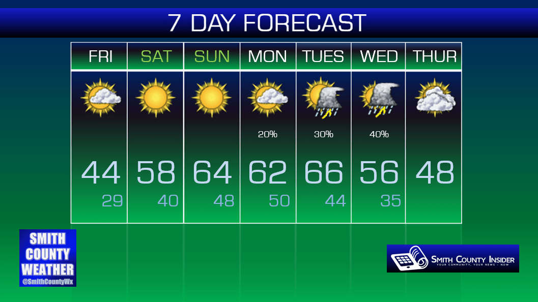
Friday — Partly sunny. Still cold. Wake up: 28˚, High: 44˚. Winds WNW at 5 to 10 mph.
As the low pressure system that’s brought us all of this unsettled weather over the past couple of days continues its northeastward track well out of our area, high pressure will begin to take hold of our weather. Friday will remain cold, but we will see a return of the sun.

We’ll see plenty of sunshine this weekend with temperatures on the rise — upper 50s on Saturday and mid 60s on Sunday!

Extended: