Friday, March 25, 2016 — 6:40 pm
Smith County Weather Alert: A FROST ADVISORY is in effect between 1 am and 9 am, Saturday.
Thursday night’s cold front sent temperatures tumbling downward, however, it was an abundance of cloud cover through much of the day that held temperatures down even further than what we were anticipating — upper 40s to around 50° vs the upper 50s to near 60° that were forecast.
We’re finally clearing out, and with little to no cloud cover overnight to trap what little warmth we did manage today, temperatures will fall into the mid 30s, allowing for scattered frost to form. For this reason, a Frost Advisory is in effect for tomorrow morning. Make sure to protect those plants!

We may also see some patchy fog overnight, so watch out for that.


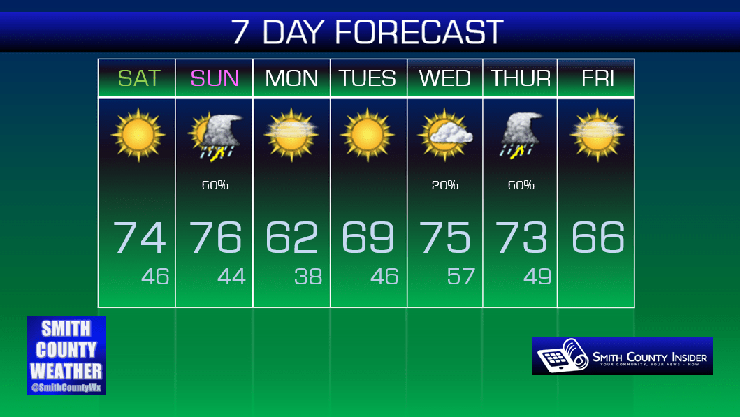
Saturday — Sunny. MUCH WARMER! Wake up: 36°, High: 74°. Winds S at 5 to 10 mph.
Temperatures tomorrow will soar nearly 40° from our morning low in the mid 30s to an afternoon high in the mid 70s! Conditions will be perfect for any ball games, practices or other outdoor activities you have planned, so get out and enjoy it!

Of course, all eyes are on Easter. Outdoor church activities, egg hunts, other plans… whether these things are able to proceed as planned or have to be moved indoors will depend upon how the weather shapes up.
Right now, we’re looking okay — during the day, that is. During the evening hours — eh…not so much.
GFS Temperatures (Sunday):
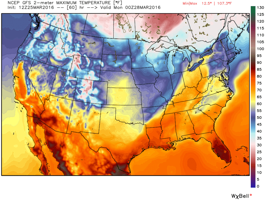
Temperatures during the day Sunday may soar all the way up into the mid 70s ahead of a cold front. Right now, the morning hours are looking dry. As we head into the afternoon, ingredients needed for storm development (including those rising temperatures) may allow for showers and thunderstorms to form. The NAM 4km isn’t suggesting much in the way of afternoon storm development, but it also didn’t show storms forming around midday on Thursday (which precluded severe storm development later in the day), either. If we see rain and storms earlier in the day, that could limit severe thunderstorm potential later in the evening by keeping everything too stable. Likewise, no rain or storms could allow the atmosphere to prime itself for strong to severe storms in the evening.
Also, CAPE (convective available potential energy), which is the amount of fuel storms have to work with, will play a key role in storm development. The higher the CAPE values, the more energy available for storms to form. Right now, the NAM 4km shows the highest CAPE values, certainly sufficient enough for severe thunderstorms. The GFS also favors a high-ish CAPE, while the EURO shows some CAPE in place, but low enough to suggest a relatively stable atmosphere in place, which could limit severe storm potential.
The Storm Prediction Center has us in a Slight Risk area for severe storms Sunday, mainly for the afternoon through late evening hours.
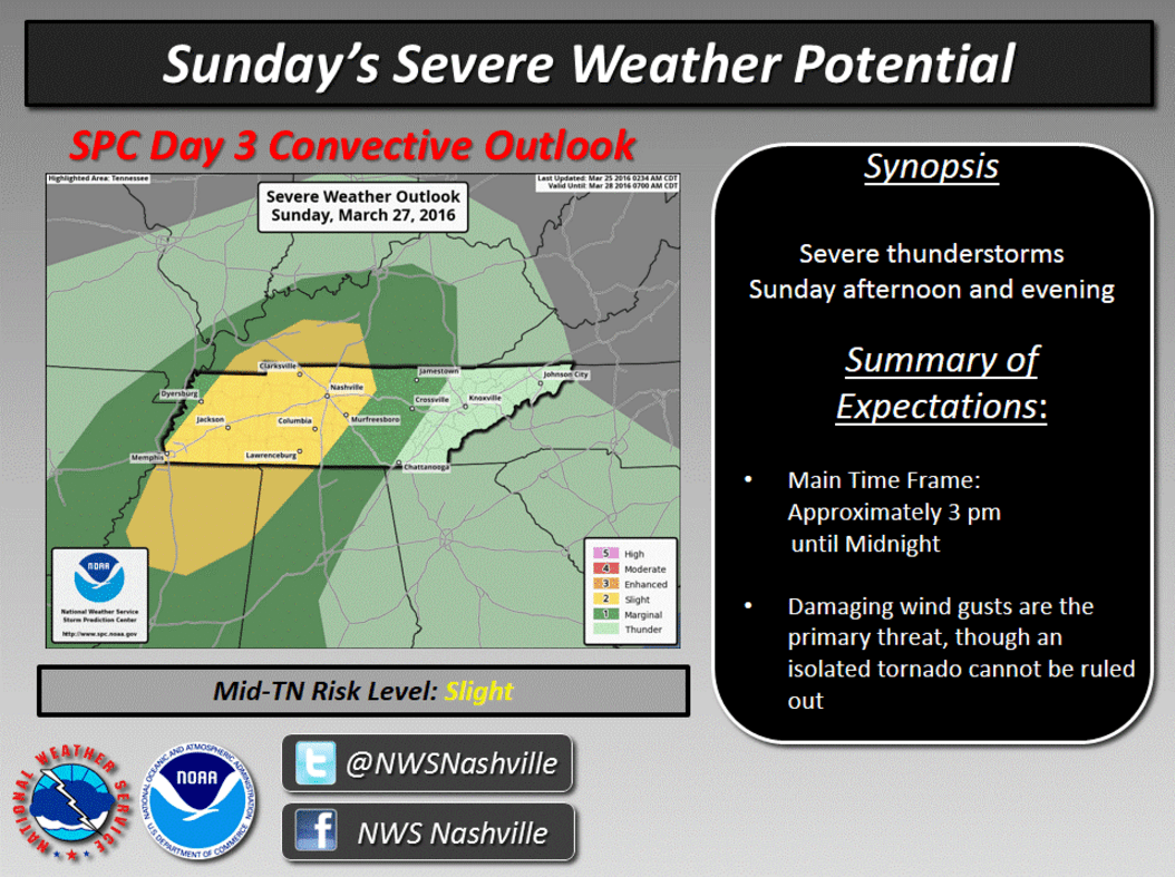
There are many uncertainties with this forecast, so exact when/where details and level of severity are things we can’t determine with precision right now. As we get closer to Sunday, models will come into better agreement, and we’ll have more information to give you.
Right now, have a backup plan just in case it rains, but at the moment, it appears the morning and perhaps early afternoon on Sunday will be dry, so outdoor plans should hopefully be able to proceed as planned. The later into the afternoon we get, the less clear the forecast becomes. A cold front will move through overnight, which could send a line of storms through late in the evening. We could see showers and storms ahead of that line, but we also could not. If we don’t, then that could mean a feistier line of storms. Also, there’s a chance afternoon/evening storm cells that pop up could also be severe. We’re not saying that will be the case, but with so many of you having plans on Easter, we want to have all of our bases covered just so you’re aware and informed.
Extended: