Monday, January 18th, 2016 — 3:39 PM

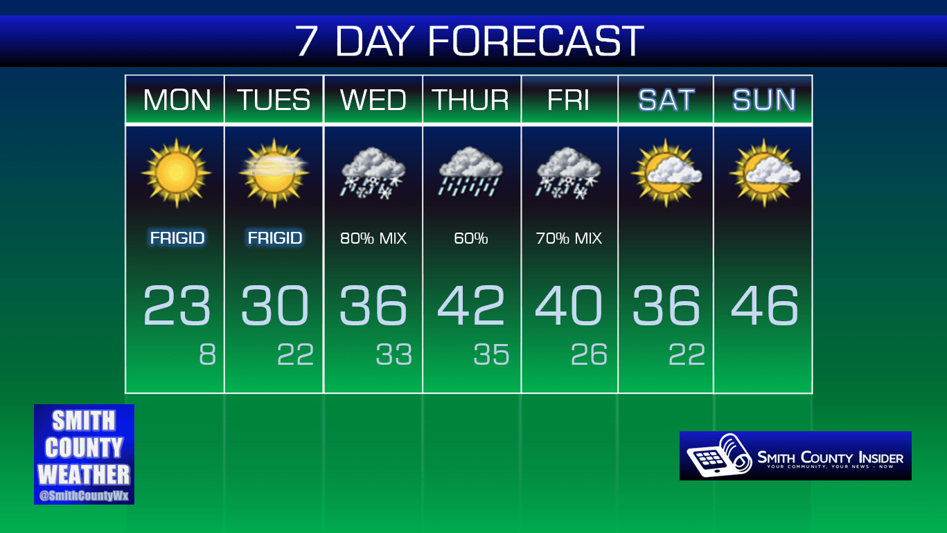
Rest of this Evening — Clear and bitterly cold. Temperatures falling into the teens. Winds WNW at 5 to 10 mph.
Been outside today? It’s cold. It’s really, really cold.
Tuesday — Mostly sunny and still cold. Wake up: 8° (that’s not a typo), Afternoon high: 30°. Winds N at 5 mph.
We’ll fall all the way down into the single digits by tomorrow morning. That’s ridiculously cold. Our high in the afternoon will climb nearly 20 degrees, but that still won’t be enough to get us above freezing — we’re going with a high around 30°. Brrrr…
Heading into Wednesday is where things begin to get very interesting…

The National Weather Service put out a Special Weather Statement earlier today. Here’s what was said about Wednesday:
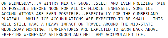
Models are all over the place with what will happen on Wednesday. Because of this, we won’t get too specific with details. There are just far too many uncertainties. We do know precipitation will be likely from at least the mid morning hours into the afternoon. It could start out as snow or sleet (or a mix), transitioning to freezing rain, and then perhaps transitioning to just rain before all is said and done. It’s possible that we may just see snow and that it will move out of our area before a transition to rain can occur. It’s possible this could be a mostly freezing rain event, which could pose icing concerns. It could be primarily all rain, although models do seem to be in agreement that there will be at least some type of winter precipitation from the start of the event, especially with temperatures expected to be several degrees below freezing during the morning hours. Again, there are too many variables at play, and a difference of just a few degrees, whether it be a few thousand feet above us or here at the surface, can change everything.
Whatever the case may be, just pay attention to multiple weather sources over the next 48 hours as models come into better agreement and forecasts become more refined.
If we do experience any ice or snow accumulation on Wednesday, temperatures in the low 40s on Thursday should take care of most, if not all, problems.
However…
Here’s the next part of that Special Weather Statement:

GFS — Thursday Evening:
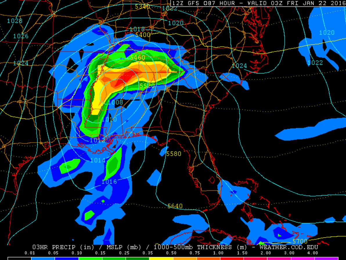
Rain will be likely Thursday evening into our day on Friday thanks to a low pressure system. The low will pull colder temperatures down as it begins to move out. *If* moisture wraps around the low with temperatures falling below freezing, that *could* give us accumulating snow. We’re not saying that will happen. Not by a long shot. But it appears to be a possibility. This is many days out, and we still have another potential winter weather event to get through before we can really begin to consider the next one, so don’t worry about it right now. Things can and will change, and we will provide you with what info we have over the coming days, so stay tuned.
Neither of these systems should currently warrant a whole lot of panic or excitement, at least not yet. Models are really iffy with both systems, so our concern shouldn’t be very high, either. Again, consult with multiple other *dependable* weather sources (local news media/their meteorologists, NWS, etc) over the coming days and be careful with what you read. If someone posts a snow totals map tonight on Facebook or Twitter, check the source it’s coming from before sharing.
Extended: