


Saturday, January 9th, 2016 — 4:27 PM
Well, this just happened…

The National Weather Service issued a Special Weather Statement (above) a short while ago detailing the possibility of our area receiving anywhere from a dusting to a quarter of an inch of snow accumulation late tonight through tomorrow morning.
Of course, this recent development has us like…

Although, the reality of such a minuscule amount of snow is really like…

We talked about showers being likely this afternoon. That’s still a thing, but they’ve decided to hold off until after sunset. Forecast models aren’t always exact, although for most of you, the daylight hours of our Saturday remaining dry surely wasn’t a bad thing.
HRRR — 6 PM
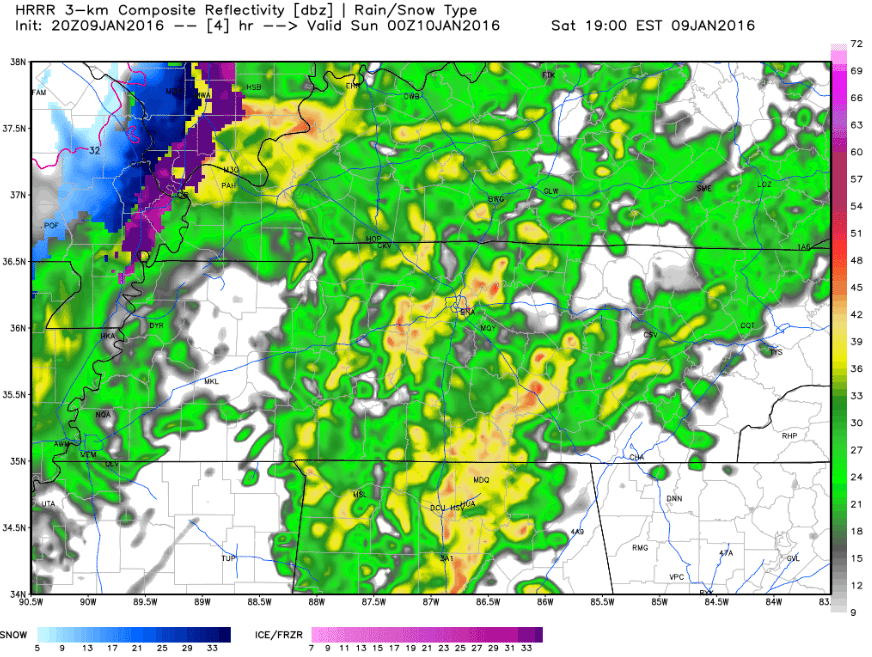
Showers are beginning to spread out across much of the mid state and should be in our area by around 6.
As colder air behind the rain quickly rushes in, we are expected a transition over to snow showers to occur.
Here’s a timeline for the transition, provided by NWS Nashville:
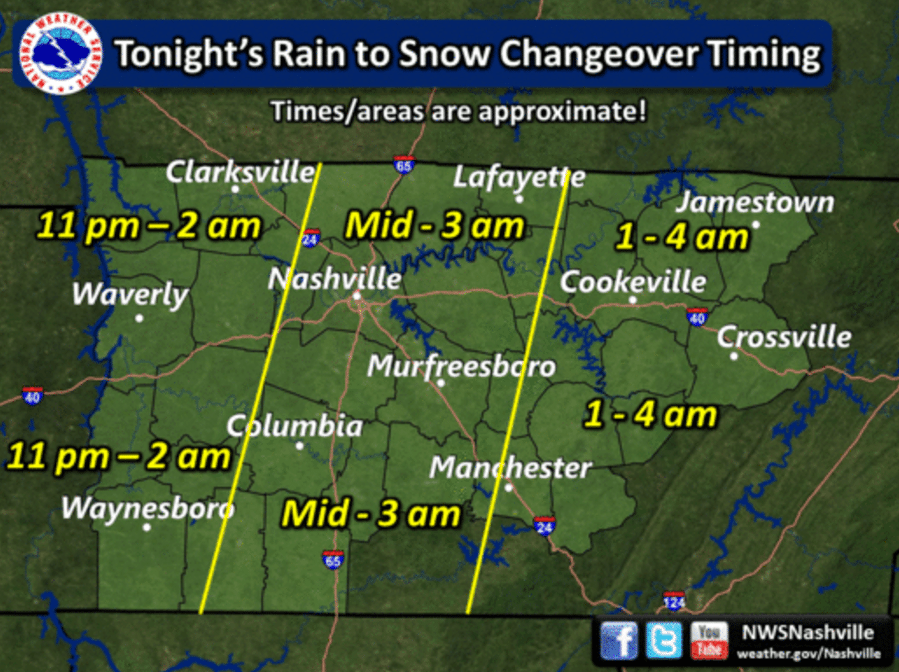
For us, we’re expecting the transition from rain to snow to occur while most of us are sleeping, likely between midnight and 3 AM.
How much could we see, you may ask?
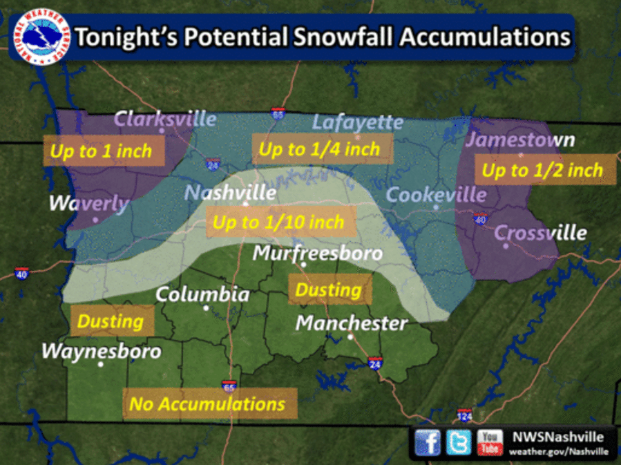
Right now, we’re looking at dusting to a quarter of an inch across most areas.
Keep in mind that forecasting snow is a tricky business. Any slight variation here or there could make a significant difference in what actually happens. Confidence is quite high that we could see a little accumulation out of this, but the parameters we would look for to see anything more than that just don’t appear to be there. However, there’s always the chance the models are off a little bit. When you wake up in the morning for church, it’s quite possible the ground outside your home will be just as barren as it is now. Conversely, the changeover to snow could happen sooner than expected, leaving us with a little more snow than anticipated. The former scenario looks more probable of the two, but either could happen. Somewhere in the middle looks most likely at the moment, and that’s what we’re sticking with.
HRRR – 5 AM:
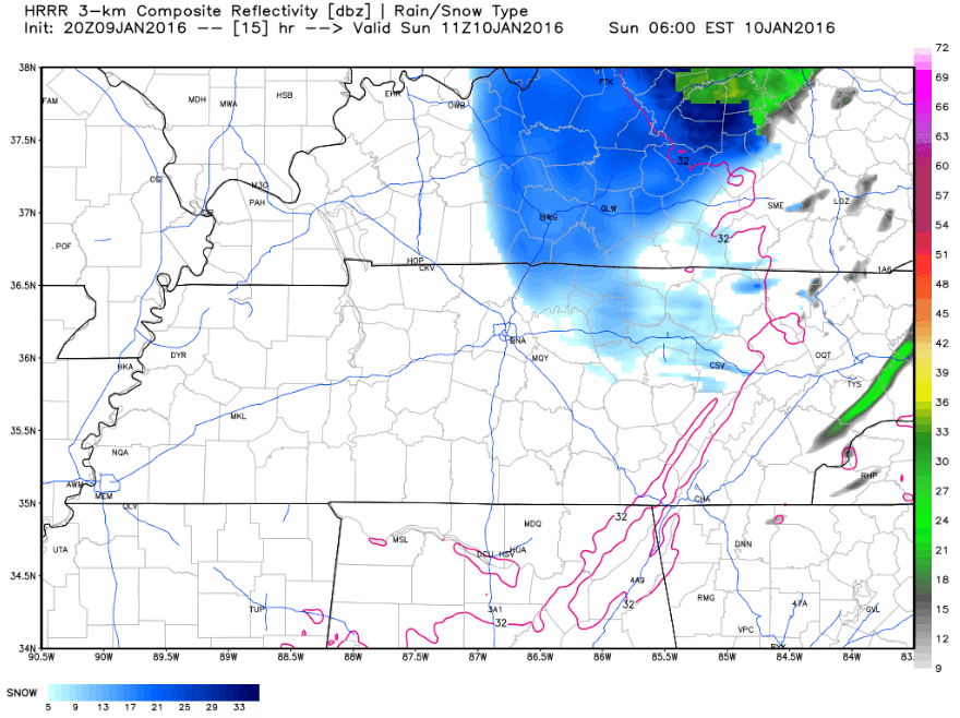
HRRR shows some light to moderate snow showers still in our area around 5 in the morning. It should all come to an end sometime around then or shortly thereafter, although some flurries could still fly around for a while longer.
Clouds will gradually clear out as we go through the day, eventually leading to mostly sunny skies in the afternoon and a very chilly high only around 30°. Even with the cold temperatures, the sun should help with anything that sticks. We aren’t anticipating any significant travel problems, but should one of our back roads develop a tricky spot or two, the sun will almost surely take care of that. If schools end up delayed or cancelled on Monday, it would be very surprising. Sorry, kids.


