


Tuesday, February 2nd, 2016 — 3:27 PM
Temperatures this afternoon have soared all the way up into the low to mid 70s. Of course, you know something is up when we get this warm in early February…
We have an Enhanced Risk for severe thunderstorms this evening and tonight.
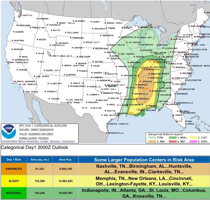
Our primary hazards are as follows (all probabilities are within 25 miles of any given location):
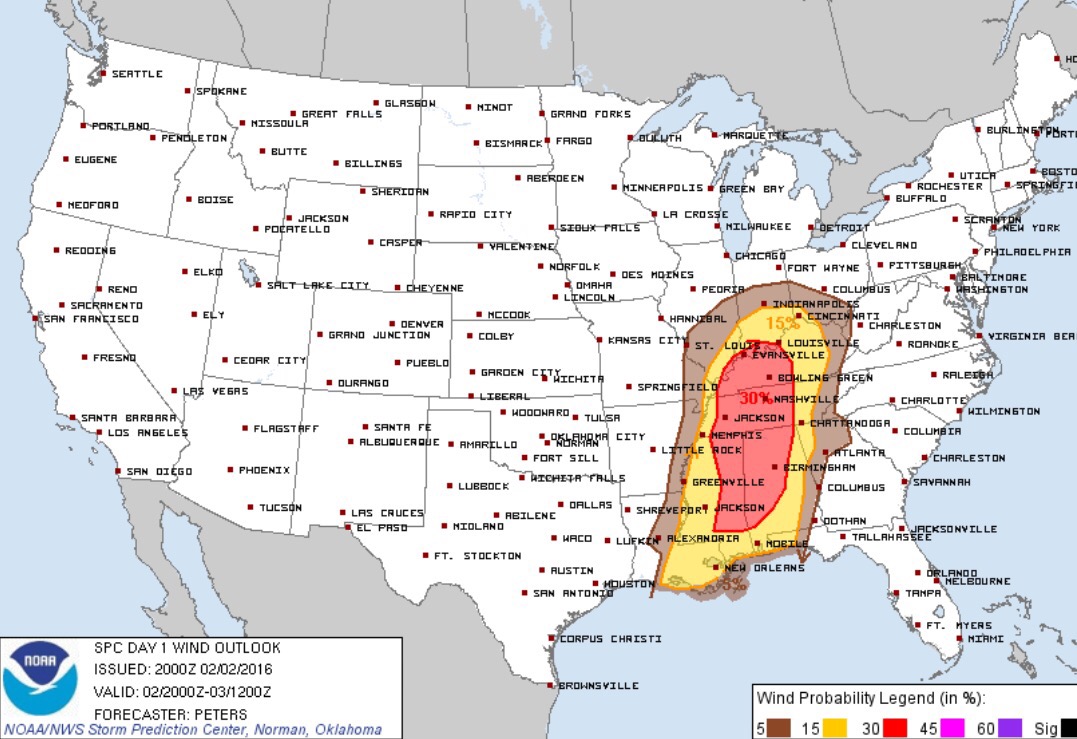
30% chance of damaging winds (58 mph or greater)
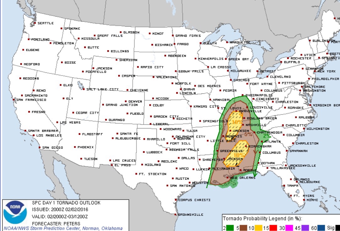
5% chance of tornadoes
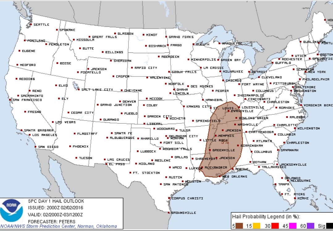
5% chance of large hail (1″ in diameter or greater)
Here’s another map from the National Weather Service detailing our concerns:
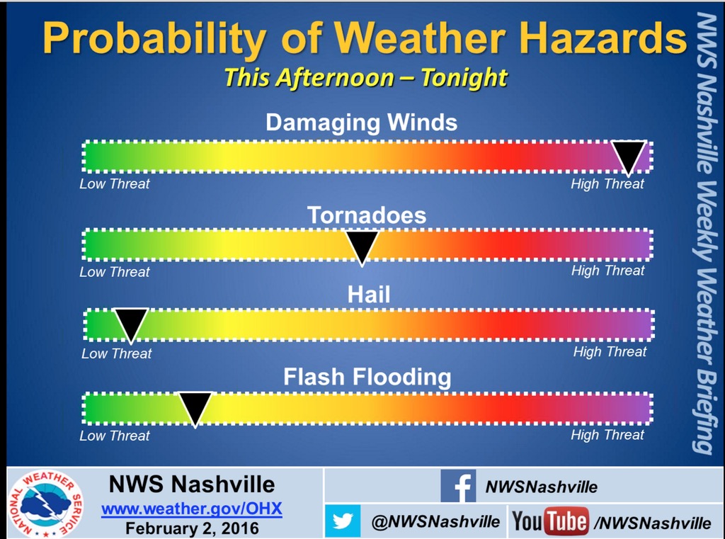
The parameters needed to generate tornadoes (including violent ones, EF-2 or stronger) are greatest over West Tennessee. Tornadoes are a possibility here, but not as significant of a threat as they are to our west.
HRRR through 4 AM, Wednesday:

We could see a couple of waves of storms before the main squall line moves through, possibly around midnight. The earlier storms could potentially be severe, but it looks like our greatest threat for severe storms will be with the squall line. Damaging, straight-line winds will be the primary concern with that line, although a pocket of hail or an embedded tornado cannot be ruled out.
Updates are being posted throughout the evening on the Smith County Weather Facebook and Twitter pages, so follow along for the latest severe weather information.


