


Sunday, March 27, 2016 — 12:44 AM
Many of you have plans to attend church in the morning and probably have other Easter-related plans after that. You probably know by now that storms are possible, and we want to provide you with as many details as we can so you’ll be fully aware of what may or may not happen and be able to adjust your plans accordingly, if necessary.
First, let’s take a look at the HRRR model. It’s our short range model that gives us a pretty decent picture of what’s to come over the next 15 hours.
HRRR loop through noon:

A relatively weak warm front will work its way northward during the morning. Because of limited moisture, this likely won’t set off any showers here, as shown in the above HRRR image.
If you have an egg hunt planned at church in the morning, it looks like we’ll be dry and those eggs (or really candy concealed in egg-shaped plastic containers, because what normal child would want to seek actual eggs that have been randomly scattered across the yard with the intent of consuming them?) can be hunted without issue. Still though, have an indoor backup plan, just in case. You shouldn’t need it, but still…just in case.


As we head into the afternoon, our chances for rain will increase with more moisture becoming available, but it will be limited. Because of this, we’re only looking at a slight chance of seeing showers or thunderstorms during the afternoon. However, any storm that does form will have a small, but possible chance of becoming severe, with damaging winds the primary concern.
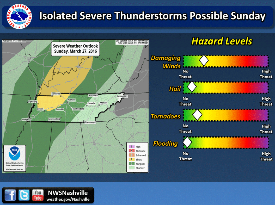
It’s for that reason that the Storm Prediction Center has us in a Marginal Risk area for severe weather. For a little while, we had a Slight Risk, but they have since backed that off to our northwest, where conditions appear most favorable for severe storm development.
Plain and simple: the ingredients just won’t be there, at least not all at once. We will have more than sufficient CAPE, or the stuff storms need to fire up, but moisture will be very limited (which is like the most important ingredient needed for storms to form), and there also won’t be much in the way of wind shear, which there would need be a lot of, ideally, in a classic severe weather setup — it just won’t be there in the same window of time the high CAPE levels are present. And finally, the eventual cold front that will move through Sunday night/early Monday morning doesn’t appear like it will pack much of a punch, which would be needed to get everything stirred up.

The NAM 4km (above) shows a relatively unimpressive line of showers and thunderstorms in weakening mode approaching us by midnight. By this point, CAPE values will have dropped quite a bit, and wind shear still won’t be that great. There will be more moisture present, but that’s about it. The storms probably won’t be severe, but we’ll keep an eye on them, as we will everything else that happens throughout the day. Follow along with Smith County Weather on Facebook and Twitter for the latest updates.
And one more thing: the STP (Significant Tornado Parameter) for Sunday is low. Really low. We’re not too worried about tornadoes, although an isolated, spin-up twister is something that can never be completely ruled out. Again though — unlikely to happen.
Summary:
- Probably dry in the morning
- *Maybe* a stray shower or thunderstorm in the afternoon
- Any afternoon thunderstorm(s) would have the best chance of becoming severe
- Main threat with a severe storm is damaging winds; even lesser hail threat
- Best chance for showers and storms will be at night, likely around midnight
- Those storms probably won’t be anything to worry about
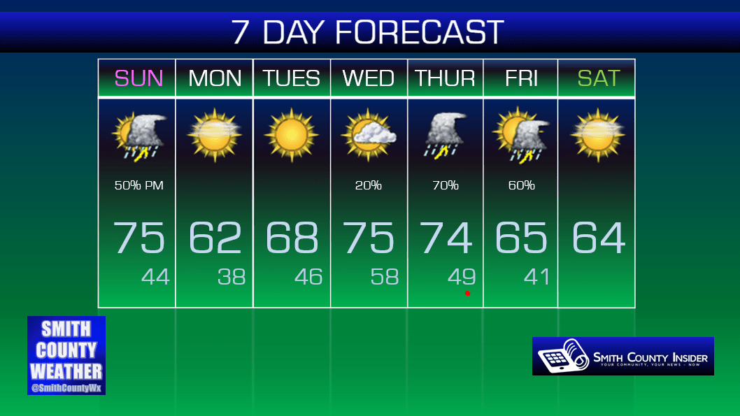
So, that’s how our Easter is looking. Once the cold front passes, we’ll cool down a bit for our Monday, but it will be nice and still mild overall.
Extended:
Have a wonderful and blessed Easter! If you are able to, try to make it to an Easter service at one of our many churches here in Smith County!


