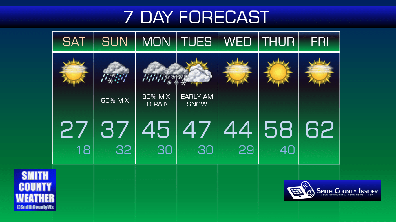
Friday, February 12th, 2016 — 11:59 PM
A few flurries will be possible overnight. Oh, and it’s going to be really cold. That’s about all there is to say about that.
Saturday — Mostly sunny. Cold. Like, really cold. Wake up: 17°, High: 27°. Winds N at 5 to 10 mph.
High pressure will dominate our weather for Saturday, and while that will mean an abundance of sunshine, it also comes with a nice northerly breeze sending ridiculously cold air down our way. We’ll only warm up about 10° from our morning low in the upper teens to a high around 27°.
Is it Spring yet?

As we’ve been discussing these last few days, all eyes are on Sunday and Monday for another potential round of wintry mess. If there’s any good news to report, it’s that we have a pretty good hold on how temperatures will shape up on Monday — too warm for snow. The bad news? We still really don’t know for sure how things will go down Sunday afternoon and evening. We do know schools are closed on Monday, so whatever happens, we don’t have to worry about that.
Let’s dive a little deeper into things…


First of all, every model has its own opinion, so trying to nail down an exact forecast with so many different opinions floating around is next to impossible. The best we can do right now is look at everything in front of us and try to determine what *might* happen.
We can’t show you the Euro model’s images for legal reasons, but it still seems to favor a pretty substantial snow event Sunday afternoon and evening. However, it is beginning to show signs of sanity with temperature profiles on Monday far too warm to support snow, and thus, it has the snow transitioning to rain on Monday.
The GFS likes the idea of the event beginning as snow Sunday afternoon and evening, transitioning to rain by midnight.
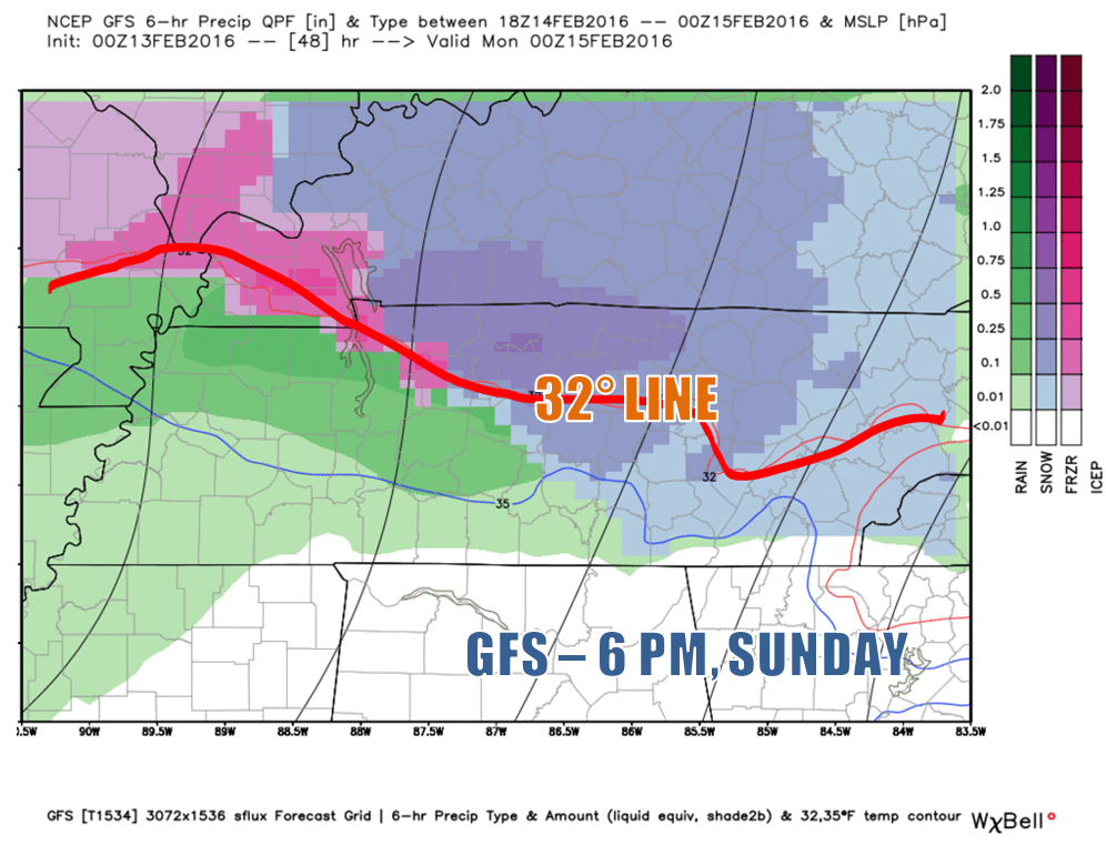

With this model run, we could see a couple of inches of snow accumulation before the transition to rain occurs. That could cause some travel problems for Sunday evening, but once the rain begins, it should all melt away with relative ease.
The NAM 4km is a shorter range model and can show us more detailed information on what could happen. We’re finally close enough that it can now show us a picture of Sunday evening into Monday.


Interestingly, this model is depicting a wintry mix of precipitation through Sunday evening, with sleet, snow, and even freezing rain possible — you know, that stuff that causes ice to form. Hopefully, we’ll only have to deal with either sleet or snow, but it’s something we’ll keep an eye on. Like the GFS, however, it too has a transition to just rain occurring by midnight. Before that happens, it throws a couple of inches of snow accumulation in there, also like the GFS. Again, whatever accumulates should melt away without much issue once the transition to rain occurs.
So, while we still don’t know for sure what exactly will happen Sunday and into Monday, we do have a better picture than we did before — and that picture will only continue to grow clearer over the next 24 hours. To summarize our interpretation of what the models are indicating (this isn’t a forecast but more of an opinion), it looks as though Sunday afternoon and evening could be a mess of wintry precipitation — likely in the form of snow, although no mode of winter weather is off limits, including freezing rain. Snow could accumulate up to a few inches before a transition to all rain occurs, either that night or early Monday morning, with showers likely throughout much of the day. Now, as we approach the evening hours of Monday, it’s possible that we could see yet another transition back over to a wintry mix or even a little snow. It probably won’t amount to much, but it’s something we’ll be monitoring as we get closer to Monday.
This can’t be said enough: much can and probably will change between now and Sunday. In fact, we may not know for sure what exactly will happen until it’s actually happening. That’s how difficult this forecast is to predict, as with most winter weather systems here in the South. It’s just part of the package of living here. We’ll continue to post details, so be on the lookout for that. You can follow Smith County Weather on Facebook and Twitter for the latest updates.
Now, one thing that is looking likely is a return to spring-like warmth by the end of next week!
Extended: