Thursday, March 3, 2016 — 9:07 AM
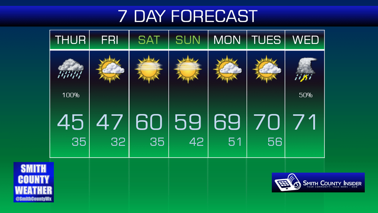
This Afternoon: Scattered showers coming to an end around sunset. Cool. High: 45°. Winds SE at 5 to 10 mph.
HRRR loop through 10 PM:

We had a spectacular sunrise this morning!


Photo from @smithcountywx on Instagram
Unfortunately, rain is taking over late this morning. Areas to the west of us have actually reported some sleet and snow mixed in! How? Temperatures aloft are well below freezing, so the precipitation is making its decent to the ground as snow. We’re well above freezing here at the surface, but temperatures don’t rise fast enough as the frozen precipitation falls to the ground, so the result is a snow and/or sleet mix. However, nothing is sticking, because again, we are well above freezing. Also, any frozen precipitation will transition to rain rather quickly, so there’s also that. You may just see all rain at your location, but if you do happen to see a little sleet or snow mixed in, now you know why.

Scattered *rain* showers will continue into the afternoon before tapering off around sunset. We won’t see much rainfall with this event — likely under a half inch in all.
Friday — Partly sunny. Wake up: 35°, High: 47°. Winds NNW at 5 mph, becoming calm.
There’s nothing of particular interest to write about tomorrow. Just another cold day. Meh.
This weekend, however…

We’re about to begin a warming trend that will take us through pretty much all of next week. The calendar may not say spring just yet, but we’re about to get our first real taste of it!
Extended: