Friday, March 4, 2016 — 7:32 PM
We didn’t see very much sun today. It kinda, sorta tried to peak through late in the afternoon, but for the most part, it was just a cloudy and cold day — about as ‘meh’ as it gets.
This weekend’s weather will be awesome.
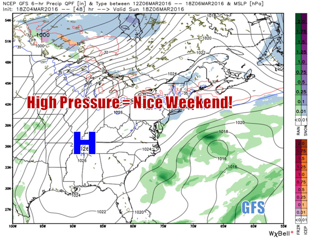
An area of high pressure will build into our region this weekend, sending those pesky clouds and below average temperatures away from us.


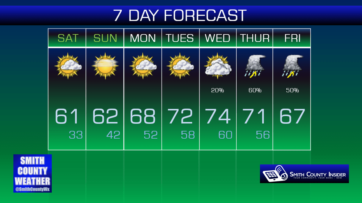
Saturday — Partly sunny. Mild. Wake up: 34°, High: 61°. Winds WSW at 5 to 10 mph.
Sunday — Mostly sunny. Mild. Wake up: 33°, High: 62°. Winds ENE at 5 mph, becoming calm.
Saturday and Sunday will be very similar, temperature-wise, although the latter will see fewer clouds. A cold front will pass through Saturday evening, but you probably won’t notice it.
Both days will be great for spending time outdoors!

This warm spell isn’t just going to last a few days and then be replaced with another round of cold blerg. No, no… Temperatures next week are going to skyrocket into the low to mid 70s by the middle of the week!
There will be a downside, however…

^there is something seriously unnatural looking about the way that dude’s arm is moving in that GIF, but it was too compelling not to share
Showers and thunderstorms will become increasingly likely as we head towards the latter half of the week. The GFS is especially keen on sending lots of rain into our area. We may even have to watch for some severe potential, although it’s far too soon to even begin to discuss that. As with any system, the closer we get, the better picture we’ll have. Right now, a 1st grader could probably provide a better illustration of what will happen than models can currently produce.

Extended:
(longest string of 60°+ days since around Christmastime, as crazy as that probably sounds)