


Friday, January 22nd, 2016 — 11:53 AM
A Winter Storm Warning remains in effect through 6 AM tomorrow.
Last night, we told you models were trending towards an earlier arrival time for the snow. And that’s exactly what happened!
Sleet began mixing in with rain just before sunrise. Snow entered the mix at around 7:30 in the Pleasant Shade area, and by around 8:30, it had spread to the rest of the county. So far, totals throughout the county range from about 1.5″ south of Gordonsville to clos to 3″ near Lafayette. More snow will continue to fall throughout the day and into this evening.
Here’s a look at potential totals:
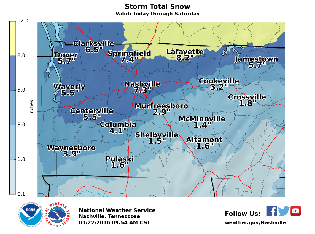
The latest accumulation map from the National Weather Service estimates around 4″ to 7″ of snow being possible through tomorrow morning. The highest accumulations will occur near Macon County, with lesser amounts down towards DeKalb County.
HRRR loop through midnight:

Snow will persist through the afternoon, slowing tapering off as we go through the evening, although snow showers will remain likely through at least the early morning hours of our Saturday.
Road conditions are in absolute terrible shape right now and will only continue to deteriorate as we head through the evening. Simply put: don’t travel unless it’s an emergency.
Snow should be out of here by tomorrow morning. With mostly cloudy skies and a high of only 31°, little to no melting will take place during the afternoon.
Mostly sunny skies on Sunday will help the melting process some, although the high will only be 39° — should help main roads, but back roads will likely remain somewhat treacherous.
Monday will make it into the upper 40s, so that should eat up any remaining issues.


