


Thursday, March 24, 2016 — 9:22 am
We have a SLIGHT RISK for severe thunderstorms today.
At the time of writing this (around 8:30 am), showers and thunderstorms were moving through West Tennessee, shown in the radar loop below:

Note: the above radar image is not live; it was captured at 8:30 am. Check for new radar updates on the Smith County Weather Twitter feed.
HRRR shows the storms arriving here around or shortly after lunchtime.
HRRR loop through 10 pm:
 ‘
‘


The storms may come in waves, with one round moving through around 1 or 2 pm, and another line later in the afternoon, around 5 or 6. These timings are NOT exact. There are many variables in play, and different models show different things. The NAM 4km has been quite a bit more aggressive with today’s storms, but it may be overdoing things.
It shows fairly strong storms arriving around 2 pm, which is in line with the HRRR — just a lot more threatening-looking.
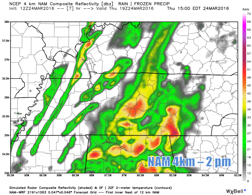
Which model is correct? That’s something that remains to be seen and is why we’ll be posting updates throughout the day to the Facebook and Twitter pages, so keep up with what’s happening by checking in there periodically and by also consulting with other multiple other reliable weather sources (not your crap app or a source that doesn’t specialize in weather; your best bet is to follow along with the local TV mets and the National Weather Service, in addition to Smith County Weather).
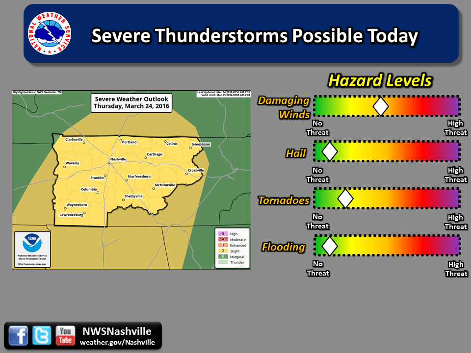
NWS has us in a fairly broad window for seeing storms today:

Between 1 and 5 pm is our best shot at seeing strong to severe storms.
This isn’t setting up to be a prolific severe weather day. Many of the ingredients needed for the big time storms just aren’t in place, with the exception of wind shear, which could generate damaging winds and possibly spin up a brief tornado. An isolated tornado cannot be ruled out today, but it’s not something we’re too worried about, fortunately.
The Storm Prediction Center thinks there’s a 15% of damaging winds (58 mph+) and only a 2% chance of an isolated tornado — both of these occurring within a 25 mile radius of any given location. The damaging wind threat is high enough to place us in the ‘Slight Risk’ designation.
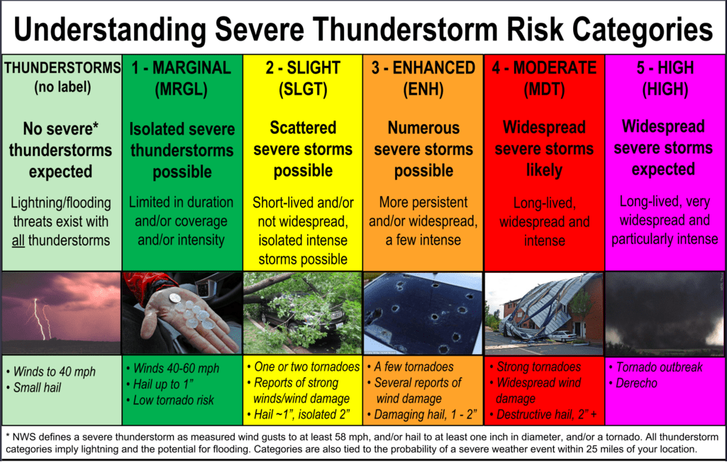
While “Slight Risk” may not sound all that threatening, it’s actually the standard risk category and should be taken seriously. The above image describes what categorizes it pretty well.
We’ll dry out this evening. A cold front (what’s driving all of this) will move through, cooling our temperatures down overnight. Tomorrow morning will be about 20° degrees cooler than this morning, with a temperature around 40°. We’ll only warm up to 58° in the afternoon, so you’ll probably want to wear a light jacket.
We’ll quickly warm back up on Saturday to the low 70s, however, we may have showers and thunderstorms to contend with for our Easter. We’ll go into greater detail about that once we get through this current storm system.
Extended:


