Wednesday, January 20th, 2016 — 4:22 PM
This morning, we had a mix of mostly sleet chased with a little bit of snow towards the end. While there might not have been much snow to play in, the sleet piled up quickly and made road conditions deplorable throughout the county. Main roads are finally clearing, but back roads that weren’t treated are still in rough shape. Temperatures this afternoon have managed to rise just a tad above freezing. That briefly helped the melting process, but temperatures will fall back below freezing after sunset — meaning many back roads, especially, will remain treacherous heading into Thursday morning.
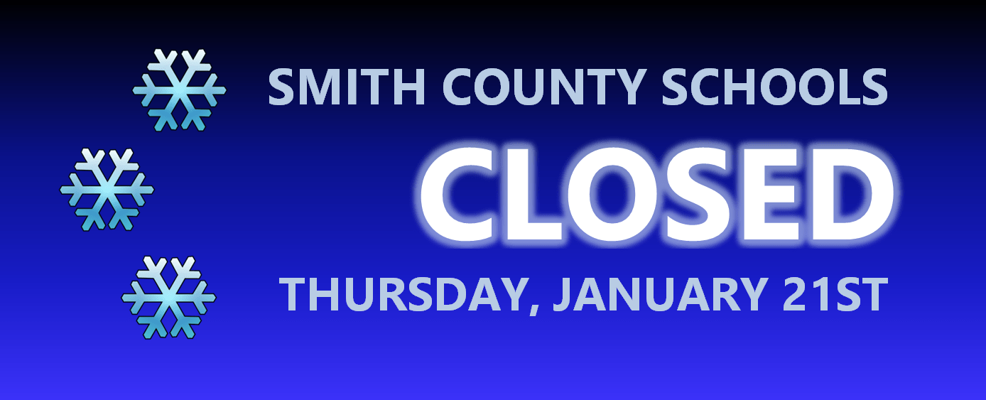
Due to roads being in such bad shape, Smith County Schools will be CLOSED tomorrow, January 21st.
Thursday — Cloudy with rain becoming likely in the afternoon. Wake up: 27°, Afternoon high: 41°. Winds ENE at 5 mph.
Much of tomorrow will be cloudy with temperatures slowing rising into the lower 40s. That should be warm enough to melt away at least some of the ice build-up on our roads. Showers late in the day will tend to whatever ice remains.
NAM 4km — Thursday at 5 PM:


Scattered rain showers will begin to move in late tomorrow afternoon and into the evening hours as a low pressure systems builds into our area. We could also hear a few rumbles of thunder overnight. Okay, that doesn’t sound so bad. What’s the catch?
NAM 4km — Friday at Noon:

GFS — Friday at Noon:

Both of the above models, the NAM 4km and GFS, along with others, are in general agreement that as the back side of the low pressure system moves through, colder air will rush in, bringing temperatures down below freezing and giving us a good shot at an accumulating snowfall.
Several factors will determine how much snow we receive.
- If the low tracks the way models currently think it will, we could see several inches of snow — but a difference in track can mean the difference between seeing a simple dusting and a foot (we can almost guarantee we won’t see a foot with this unless one outlier model has its way, which is highly doubtful; a dusting also seems improbable right now).
- Ground temperatures will be above freezing when snow begins to fall. In addition, the ground will also still be wet from rain, so it could take a little while for snow to begin to accumulate. Right now, it looks like a changeover could occur sometime around noon, but it’s quite possible temperatures could not fall as quickly as anticipated, leaving us with a shorter window to see snowfall.
- We may not see a straight rain-to-snow transition. There could very well be a period of sleet before it changes over to all snow, also lessening total snowfall accumulation potential.
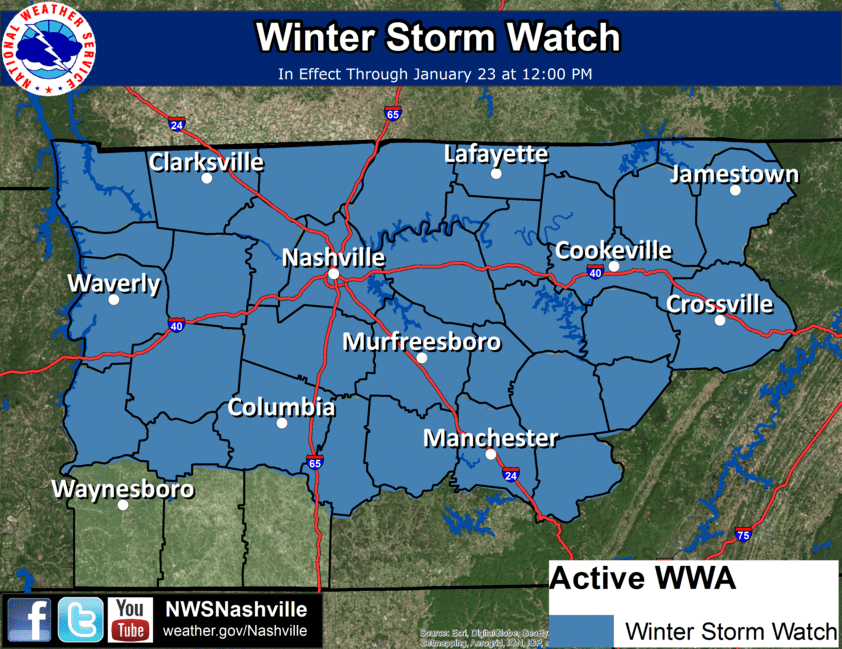
With all of that being said, it’s a bit too early to give any specific snowfall estimates. The National Weather Service posted a broad 1 to 5 inch estimate on Facebook a short while ago, with higher amounts possible the farther north you go. They do, however, anticipate a significant winter weather event that will likely pose even greater impacts than today’s. For this reason, they have gone ahead and issued a Winter Storm Watch that is in effect from 6 AM Friday through Noon on Saturday. Significant travel impacts will be possible, they went on to say.
Snow showers could linger into the early morning hours of our Saturday before tapering off later in the day.
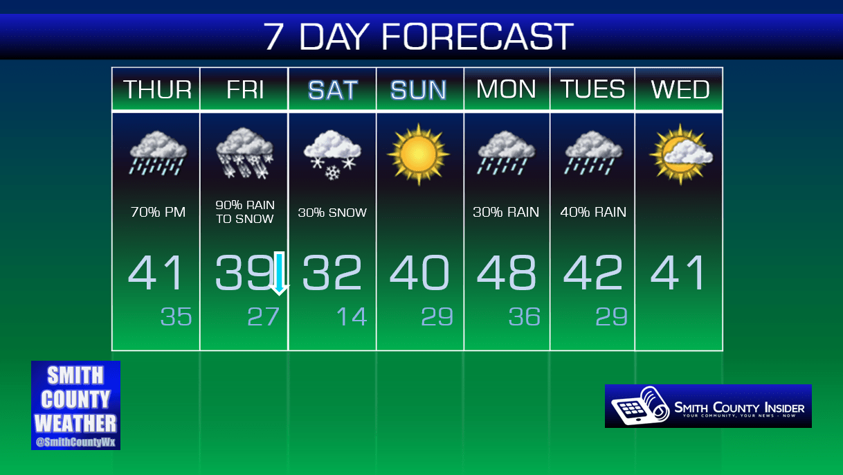
Summary: We do anticipate a significant winter weather event on Friday. Morning rain will transition to snow (with a mix of sleet and freezing rain possible in between) sometime between the late morning and early to mid afternoon hours. Accumulating snowfall looks very likely, although it’s tough to give an estimate at this point of just how much we’ll receive — we should be able to provide that by tomorrow, so stay tuned.
Forecasts will be refined further over the next 48 hours, so consult with multiple *reliable* weather sources between now and then to stay as weather-aware as possible, especially with a Winter Storm Watch in effect.
…and one more thing: be smart with what you share on social media. We mentioned an outlier model that hints at upwards of a foot of snow. Images of this model have begun to spread across social media. If you see something like that, consult with us either on Facebook or Twitter at our Smith County Weather page, or with other trusted weather sources, first before sharing. We can’t fully rule out the possibility of us seeing that much snow, but it seems highly unlikely.
Temperatures will gradually rise as we head into the latter half of the weekend and the first part of next week, so whatever problems develop, there will be several opportunities for melting to take place.
Extended: