Thursday, March 31, 2016 — 10:20 am
We have a SLIGHT RISK for severe thunderstorm today, mainly for late this afternoon through this evening.
We were Enhanced Risk until the 11:30 am SPC Day 1 Outlook update came out. They nudged us back down to Slight Risk. Literally the only difference is our hail threat went down a little. Everything else remains the same.

So, what do you need to know for today?
Well, as we’ve been discussing for the past couple of days, severe weather is a possibility this afternoon and evening. It’s appeared that many of the ingredients needed to form severe storms may come together after morning showers depart. The biggest keys being how soon the rain leaves and if we see an extended period of clearing — with the sun making an appearance.
9 am Radar Image:
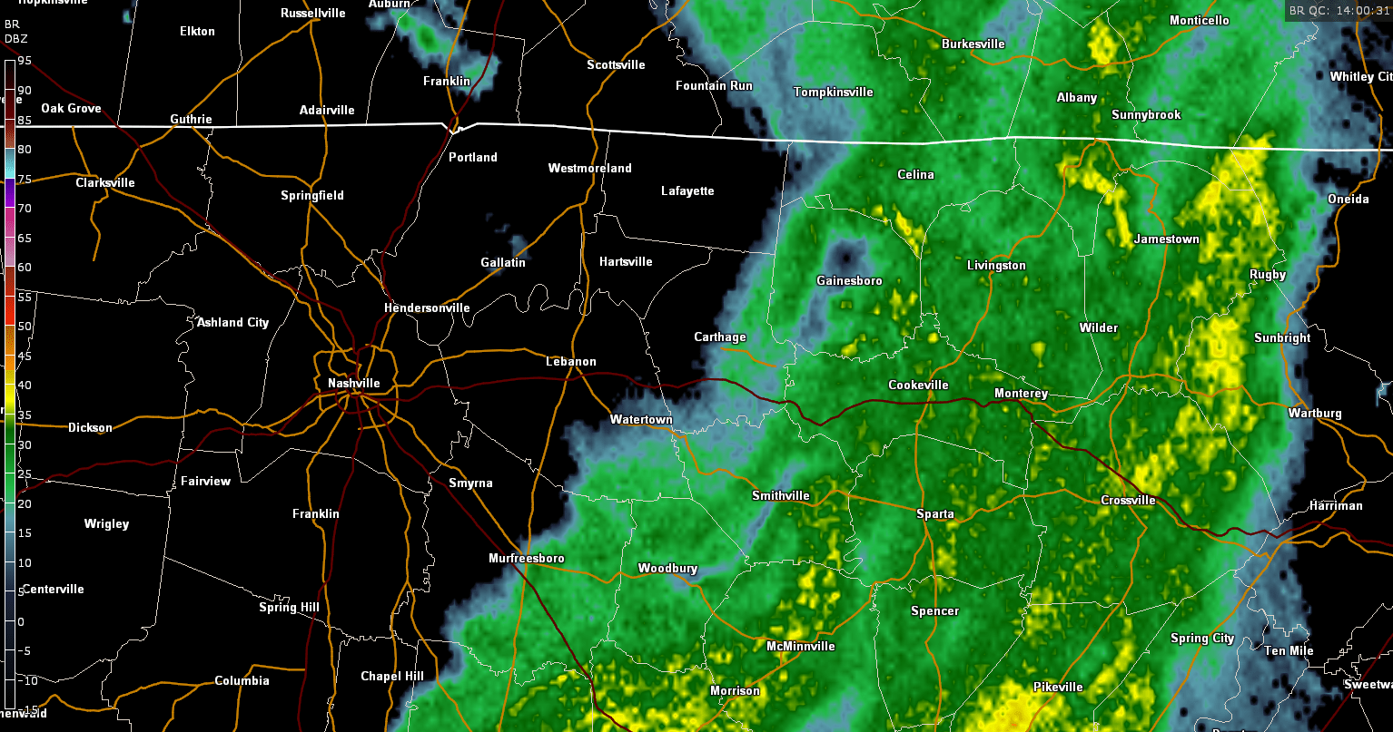
As of 9 am, our first round of rain and ‘storms’ (didn’t really “storm,” but it will later, so we’ll go ahead and use the term here, too) was moving out of the county. That’s not a great thing, because that gives us quite a bit of room for the atmosphere to re-energize, which could lead to some pretty nasty storms to form later. There’s no guarantee that everything will come together just right, though.
Key ingredients for severe storms today:
- High Dew Point. At the time of writing this (9:15 am), our dew point is in the mid 50s. That number needs to increase to the mid to upper 60s by late this afternoon. Models think will happen. We have reason to be skeptical, as that’s a pretty big jump in a not-so-long amount of time.
- CAPE (convective available potential energy). CAPE is the amount of fuel storms have to work with. This morning, that number is at 0. We need it to be over 1,000. Again, models are quite certain this will happen, going as high as 1,500 or so, in fact.
- Sunshine. Storms love the sun. The more we see, the more energy will become available for storms to work with. With the morning showers having departed, that opens the door for the sun to appear. But the more clouds hang around, the less our temperatures will warm up, and the more limited severe weather development will be.
- Wind Shear. This is what gets the storms rotating. We don’t want a lot of this. Models point toward modest wind shear this evening, but not prolific levels. That’s a good thing to some degree, but it doesn’t mean we’re out of the woods for severe weather, including tornadoes, by any stretch, especially if we have the other ingredients in place.


Now, let’s talk timing.
The first round of rain is over with. We’re now waiting for what’s to come.
We might be waiting for a while…

The National Weather Service thinks our best chance for seeing severe storms will be between 4 pm and 10 pm. However, that doesn’t mean we can’t have severe weather before or after that. That’s just when the ingredients look most likely to be in place for storms to happen.
HRRR loop through 11 pm:

The HRRR is generally pretty good, but for whatever reason, it’s not showing the morning round of rain (that’s already moved well east of us) moving out until around noon, so take what you see with a grain of salt. It’s hinting at the potential of a few clusters of storms beginning late this afternoon and going through around midnight. Of course, one has to wonder if those could be supercells, in which case, that’s very concerning. We don’t think that’s something we’ll have to worry too much about this evening, but it’s something we’ll most definitely be keeping an eye on.
Models have hinted at a line, perhaps a squall line, moving through just ahead of the cold front tonight, probably around or just before midnight. HRRR is wanting to paint that squall line forming east of us, but there’s reason to believe it will form to our west and then push through here late.
To be completely honest, we’re going to have to wait and see what happens. And please, don’t bombard Smith County Weather’s notifications with questions on when or where, because a) those questions will be answered with periodic updates throughout the day and b) trying to predict ahead with this system, especially several hours into the future, is extremely challenging, so some of your questions might not can be answered beyond what is said here — which is why, as James Spann says, you should: “read the blog!”
Finally, what are our main threats today?

The above graphic was from the Enhanced Risk. Will try to have the updated Slight Risk version as soon as it’s available.
SPC has outlined our threats as large hail at 15%, damaging winds are also 15%, and tornadoes are 5%. If we get some sunshine and ingredients come together nicely (and not the good kind of ‘nice’), then it’s possible those threats may increase. It’s wait and see right now.

We also worry about flash flooding this evening with any storms that form, especially if they linger over us for a while. With all the rain that fell this morning, the ground is very saturated. Any additional rainfall will have trouble seeping into the ground and may pile up in some places, so be especially careful out driving this evening (which we don’t recommend; this is probably a good evening to stay home and preferably somewhere with a safe place to take shelter in case you need to, but that’s ultimately your call to make).
So, we’re just waiting right now. There’s certainly a boom/bust potential with this forecast, and hopefully the way we’ve presented all of the above information to you clearly indicates that. If nothing happens (storms will almost certainly happen, they just might not be severe), then that’s a good thing! On the flip side, if we have really rough severe weather, then we want you to have been as informed as possible ahead of time.
Follow along with Smith County Weather on Facebook and Twitter today for the latest updates. It’s also a good idea to consult with multiple other reliable weather sources throughout the day. And finally, make sure your weather radio or alert app is set to go off in the event that a watch or warning is issued.
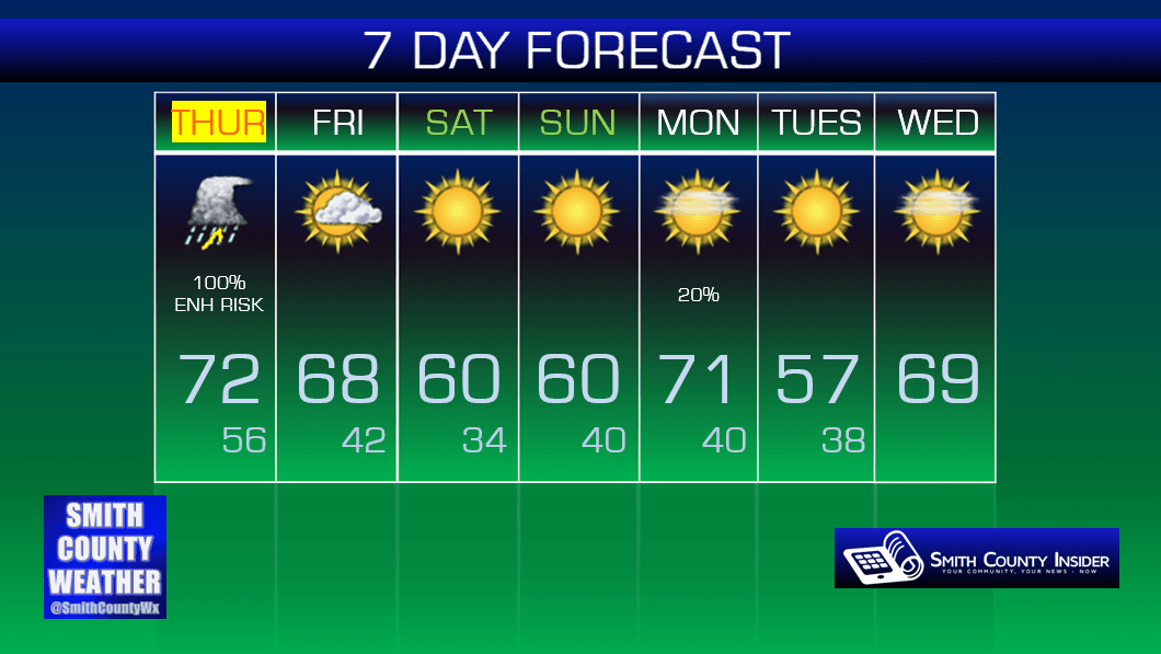
Extended: